General information
Location
District - Severodonetsk district, Luhansk region;
Community - Lysychansk city community
City - Myrna Dolyna urban-type settlement
Myrna Dolyna urban-type settlement, Lysychansk city community, Severodonetsk district, Luhansk region;
Kind of cultural heritage
ArchaeologicalObject type
СonstructionsViolation type
information is clarifiedResearch zone
Luhansk regionObject history and violation description
Date of creation of the barrow group: Bronze Age – Middle Ages;
Status of the site: entry in the encyclopedia Collection of Monuments of History and Culture of Ukraine, protection number 3455.
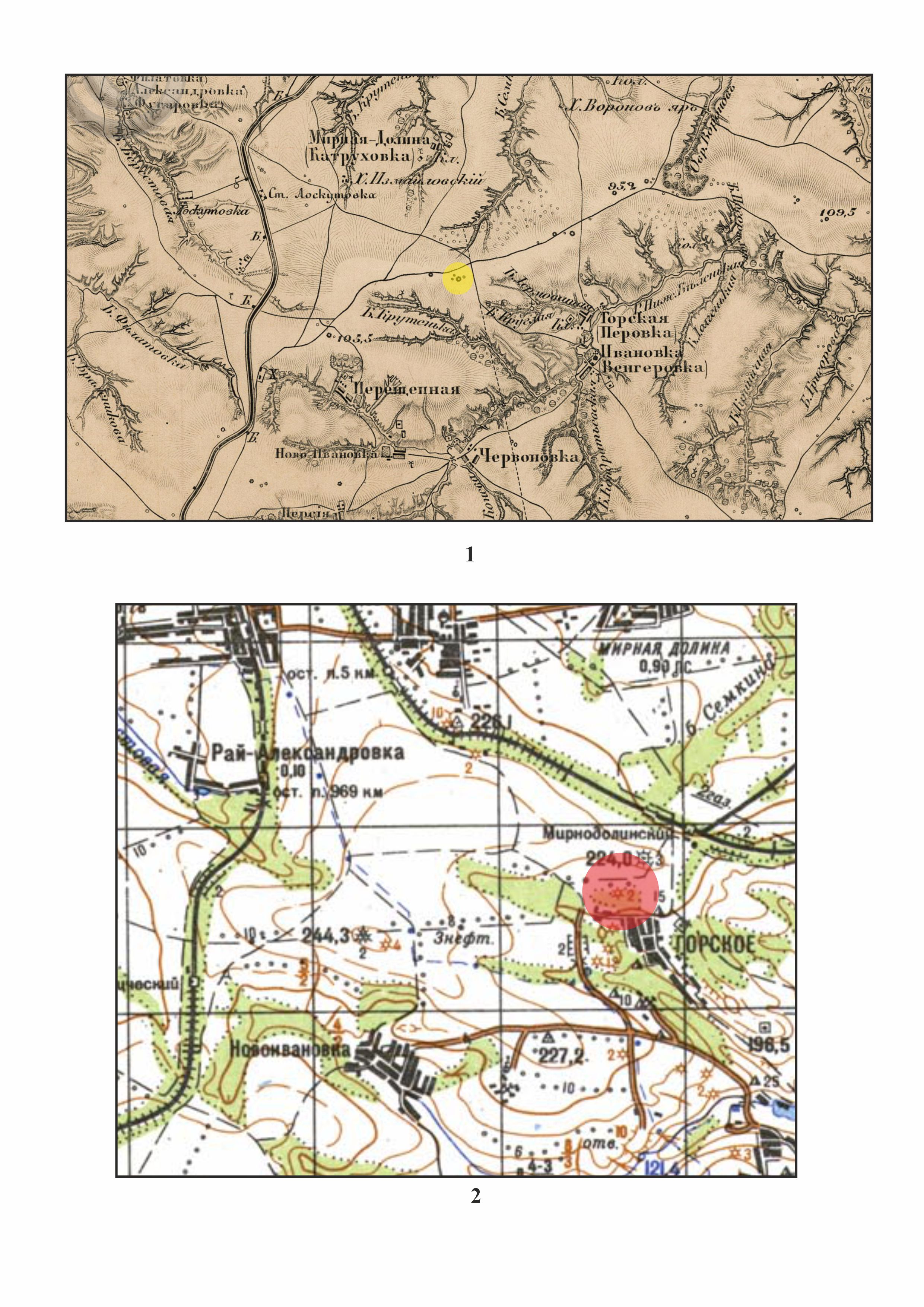
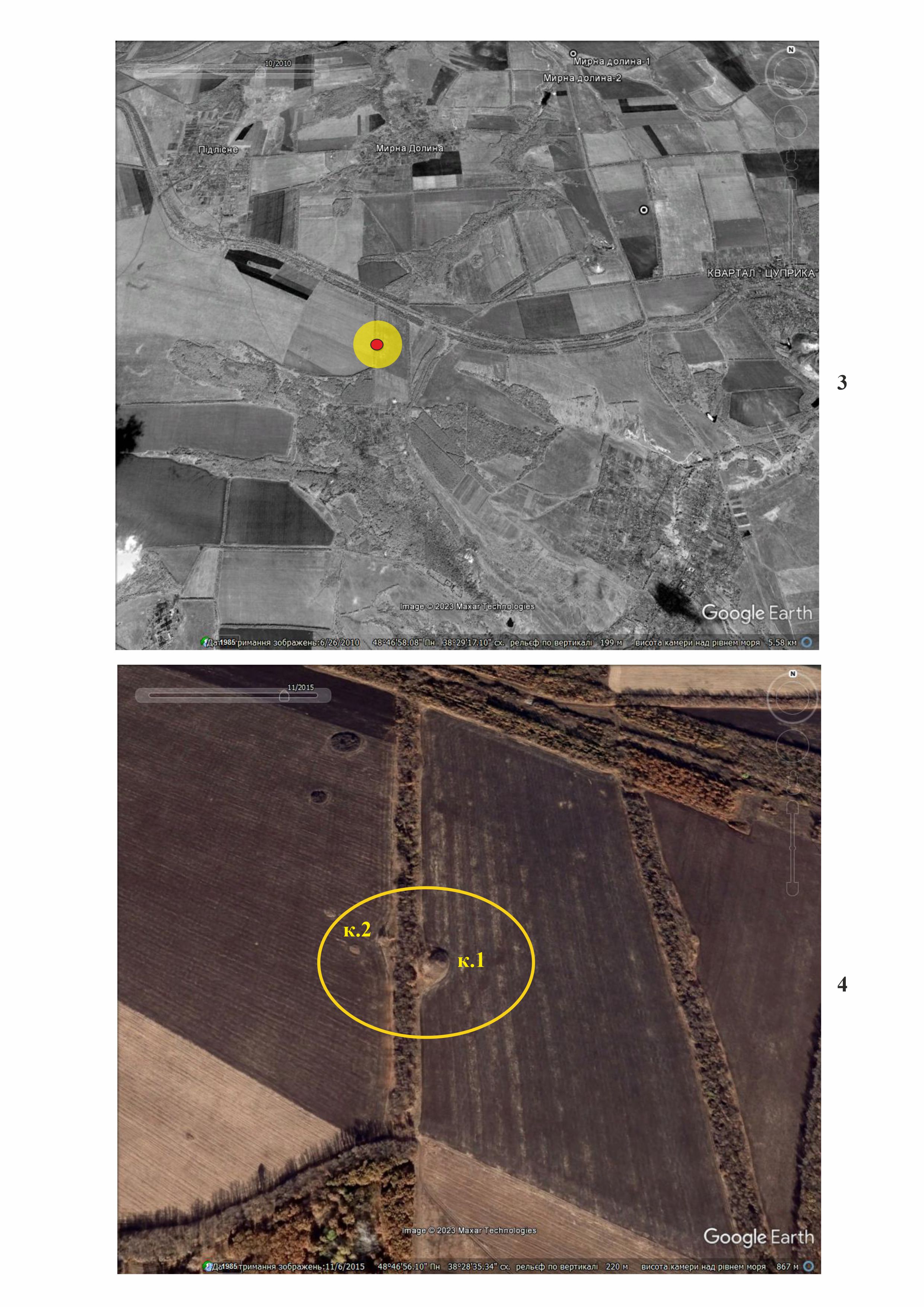
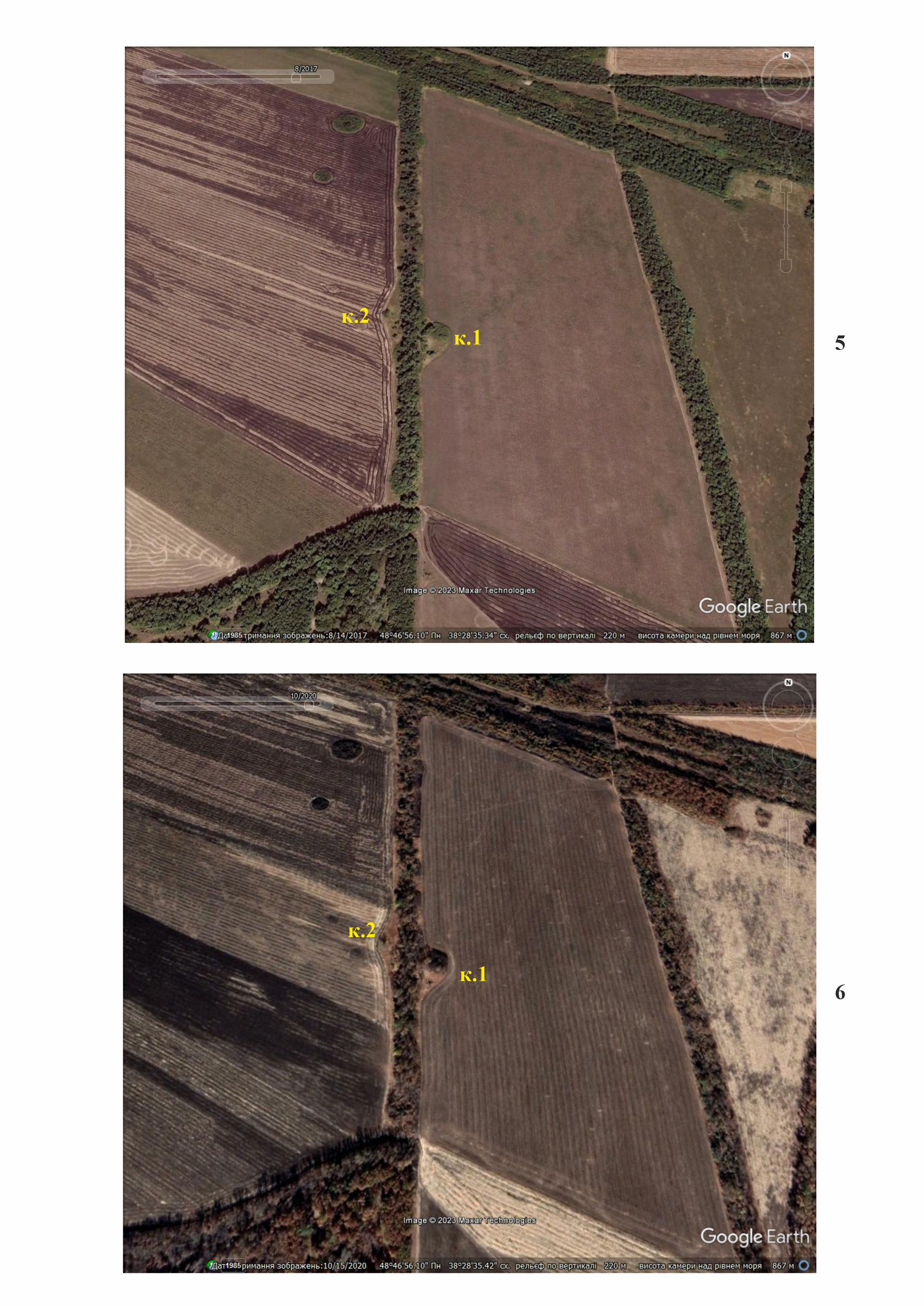
Location. The barrow group consists of two mounds and is located in the windbreak area in the watershed between the Berestova and the Siverskyi Donets rivers, 2.9 km south-southwest of the central part of Myrna Dolyna urban-type settlement (from the Ukrposhta branch No. 93321), 4.2 km east of the railway connecting Luhansk with Lysychansk and Svatove, 2.7 km west of the regional road R-66 (Domino-Oleksandrivka-Svatove-Kreminna-Rubizhne-Severodonetsk-Lysychansk-Luhansk). The field on which the barrow are located is plowed. According to the register of archeological sites of local importance in Luhansk region, the diameter of barrow 1 is 30 meters and the diameter of barrow 2 is 13 meters. The height of barrow 1 is 1.4 meters and barrow 2 is 0.4 meters high. On the sides of the windbreak area, where barrows are located, there are arable lands, which were regularly plowed. The fields of both barrows overlook the fields; however, according to satellite images, they have not been plowed.
Brief historical reference.
The map of the second half of the 19th century depicts one large barrow and three smaller ones (Figure 1). Two barrows are shown on the map of the General Staff of the USSR (Figure 2). In 1989, the barrow group was examined by researchers of the Voroshilovgrad (now Luhansk) Regional Museum of Local Lore, O. Gorelikov and V. Vybornyy.
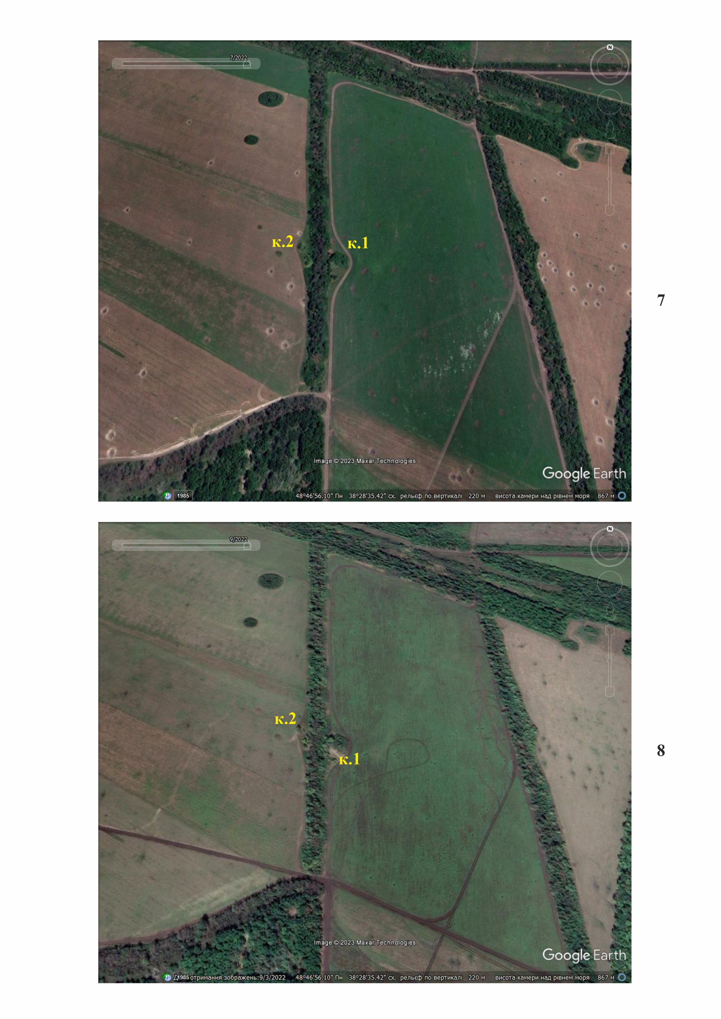
The condition of the barrow group in the period from 2014 to 2022. On satellite images from 2014 to 2022, no activity around the mound group is recorded (Figures 3–6). The events of 2014 bypassed these places. But already in the images for July and September 2022, you can see numerous traces of shell explosions around the mounds, some of which are recorded directly on the embankments and floors (Figures 7, 8).
Thus, the barrow group has been damaged as a result of shelling caused by Russian aggression. It is possible that the area around the barrows contains explosive objects.
Gallery


Additional files
information is clarified
Involved persons
- - the Russian military
Video gallery
information is clarified
Sources
information is clarified
Links
information is clarified