General information
Location
located 1.8 km south – southeast of the southeastern outskirts of Myrne village, Orikhiv urban territorial community, Polohy district, Zaporizhzhia region
Kind of cultural heritage
ArchaeologicalObject type
СonstructionsResearch zone
Zaporizhzhia regionMap
Object history and violation description
The territory near the Velykyi Luh (“Great Meadow”) boasts a huge number of mound necropolises (Table 1). The terms “barrow” or “grave” mean a round or long mound of earth erected over one or more burials. The first barrows emerged in the steppe zone of the Northern Black Sea region in the 4th millennium BC and existed until the 1st half of the 2nd millennium AD. The long-term use of such embankments as necropolises gave rise to barrow groups.
The barrows contain layers of several historical eras. Burials carried out at different depths are divided into main and inlet burials. Each time, the barrow was filled in, stone stelae and wooden pillars were installed on its top. The barrow was repeatedly used during trizna – rites related to honoring the souls of buried ancestors.
Archaeological research in the territory of the Zaporizhzhia region was carried out in the 1970s and 1980s during the heyday of excavations associated with the growing construction of land amelioration structures. The same period marked the beginning of the inventory of cultural heritage sites.
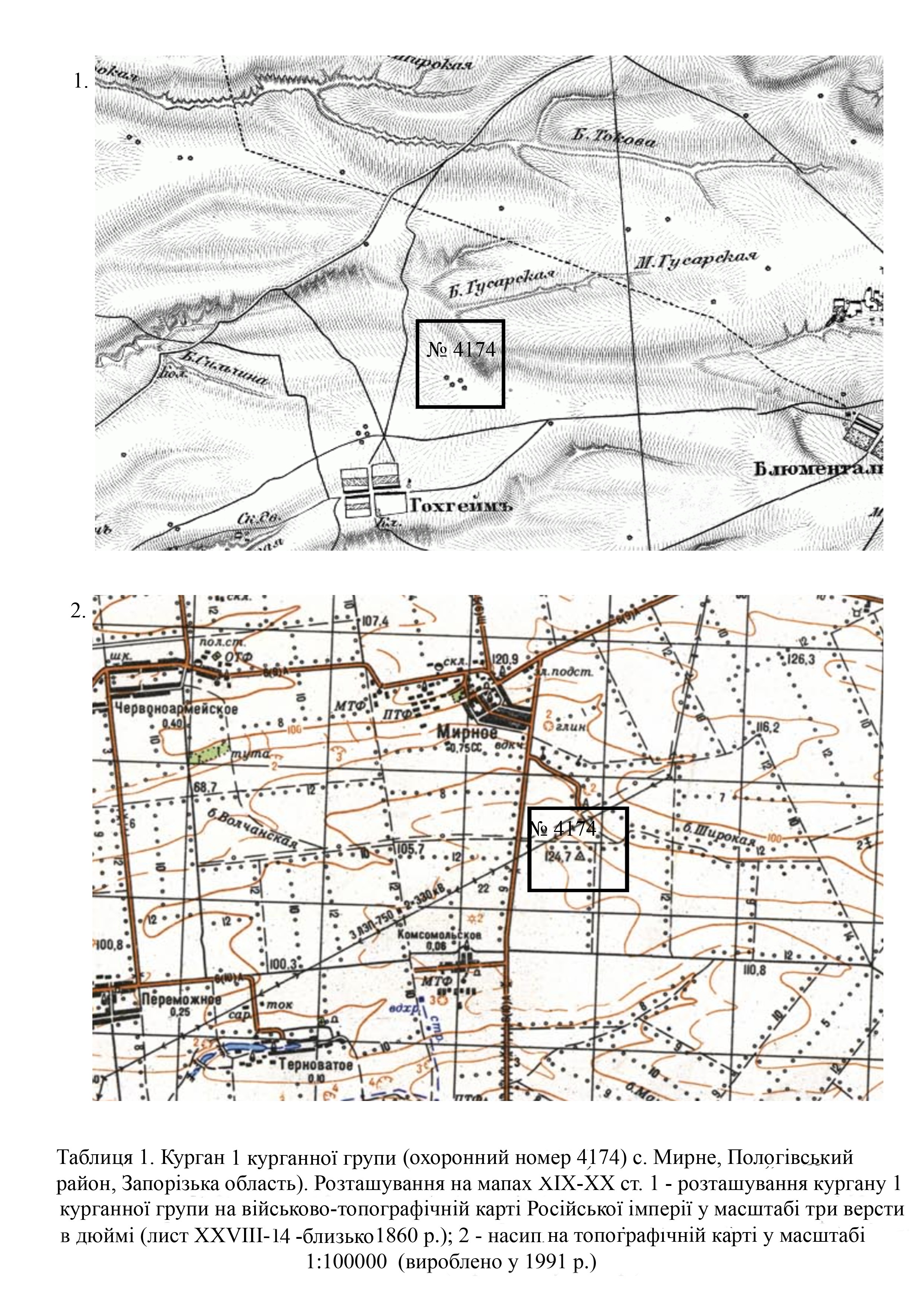
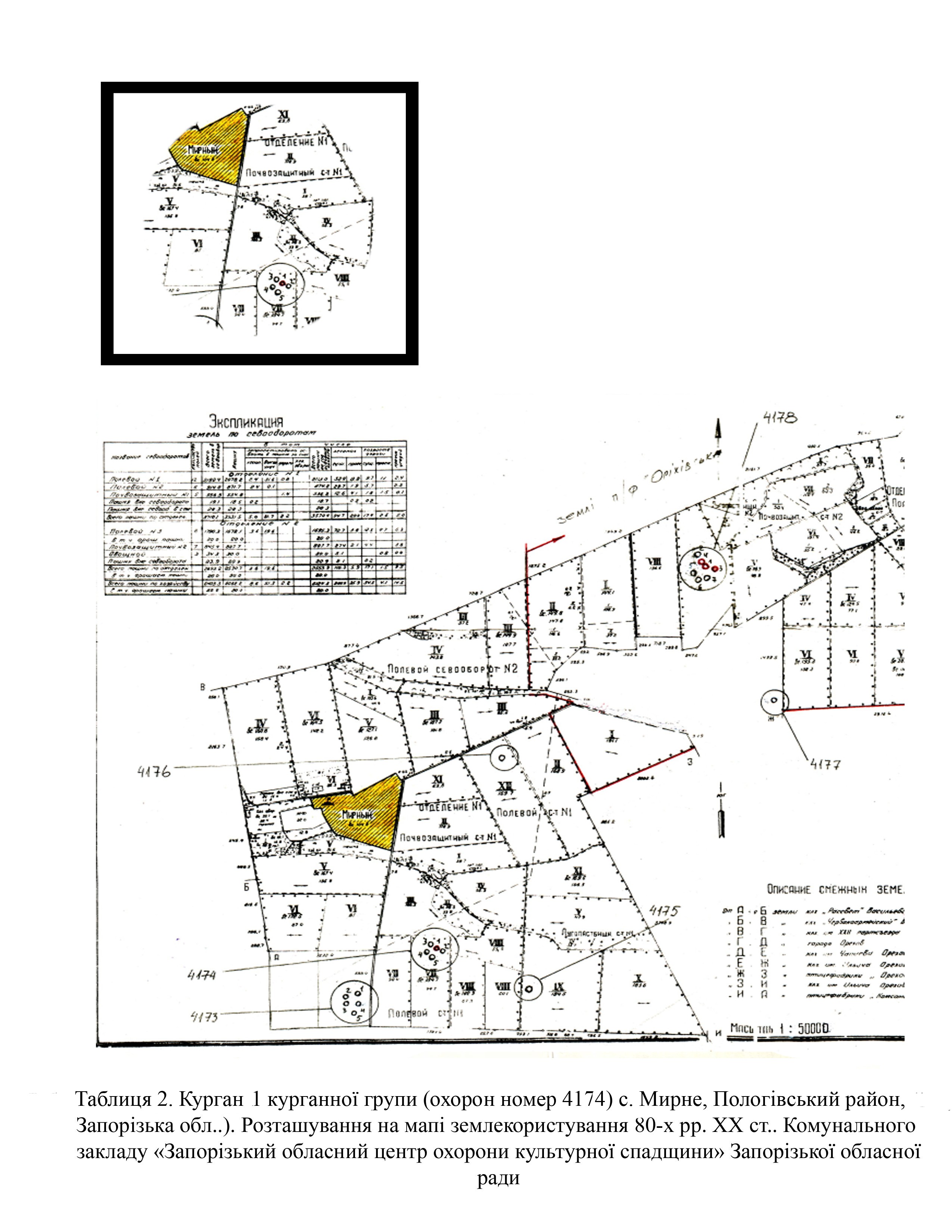
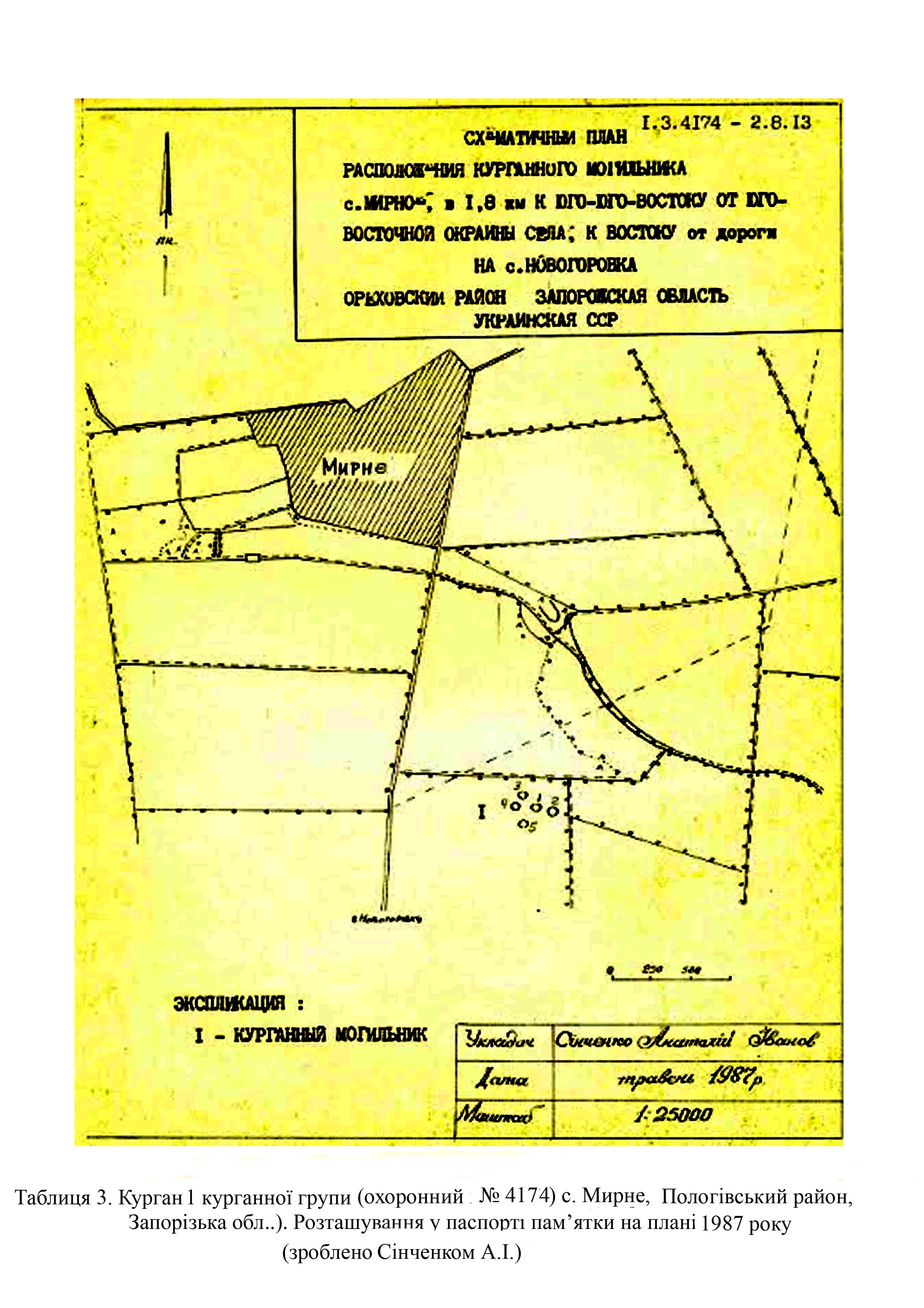
Barrow 1 of the barrow group (protection No. 4174) was first examined by I. Tykhomolova, a senior research fellow of the Zaporizhzhia Regional Museum of Local Lore, in 1986 (Tables 2; 3).
In 1996, the executive committee of the Zaporizhzhia Regional Council of People's Deputies decided to include the barrow in the barrow group under protection number 4174 and in the list of archaeological sites of local importance (No. 161 of March 11, 1996).
The barrow meets the criteria of authenticity and is also associated with historical events, beliefs and the development of culture in this area.
According to the site’s records, the barrow is a mound of round shape in plan and segment-shaped in cross-section. It is the largest one among the five barrows of the group, located in the watershed between the Husarska and Zenova gullies. At the top of the mound, there were the remains of a destroyed geodetic mark. The surface of the mound features the remains of old sunken pits (Tables 2; 3). Mound parameters are as follows: height – 2.7 meters; diameter – 38 meters.
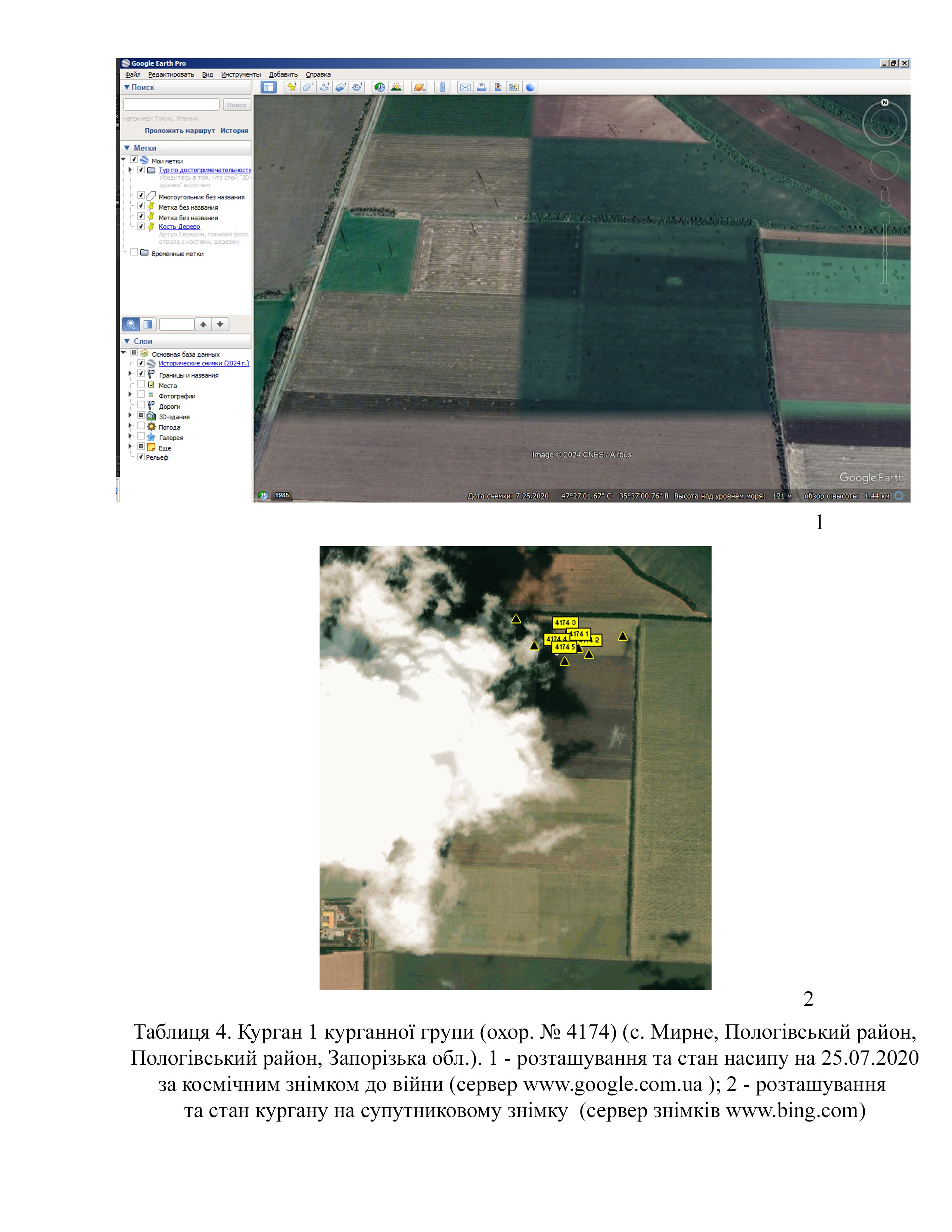
In the space images from July 25, 2020 from the Google Earth Pro server (https://google-earth-pro), it is clearly visible that the barrow had no significant damage (Table 4).
According to the map of the war chronology, during the southern offensive, in March 2022, this part of the Orikhiv territorial community was occupied by Russian troops (Deep State map https://deepstatemap.live).
From 2022 through 2024, the following units were stationed here: the 429th motorized rifle regiment, 125th motorized rifle regiment (DPR), 45th separate special forces brigade, 503rd motorized rifle regiment, 237th airborne assault regiment of the 76th division, 234th airborne assault regiment of the 76th division.
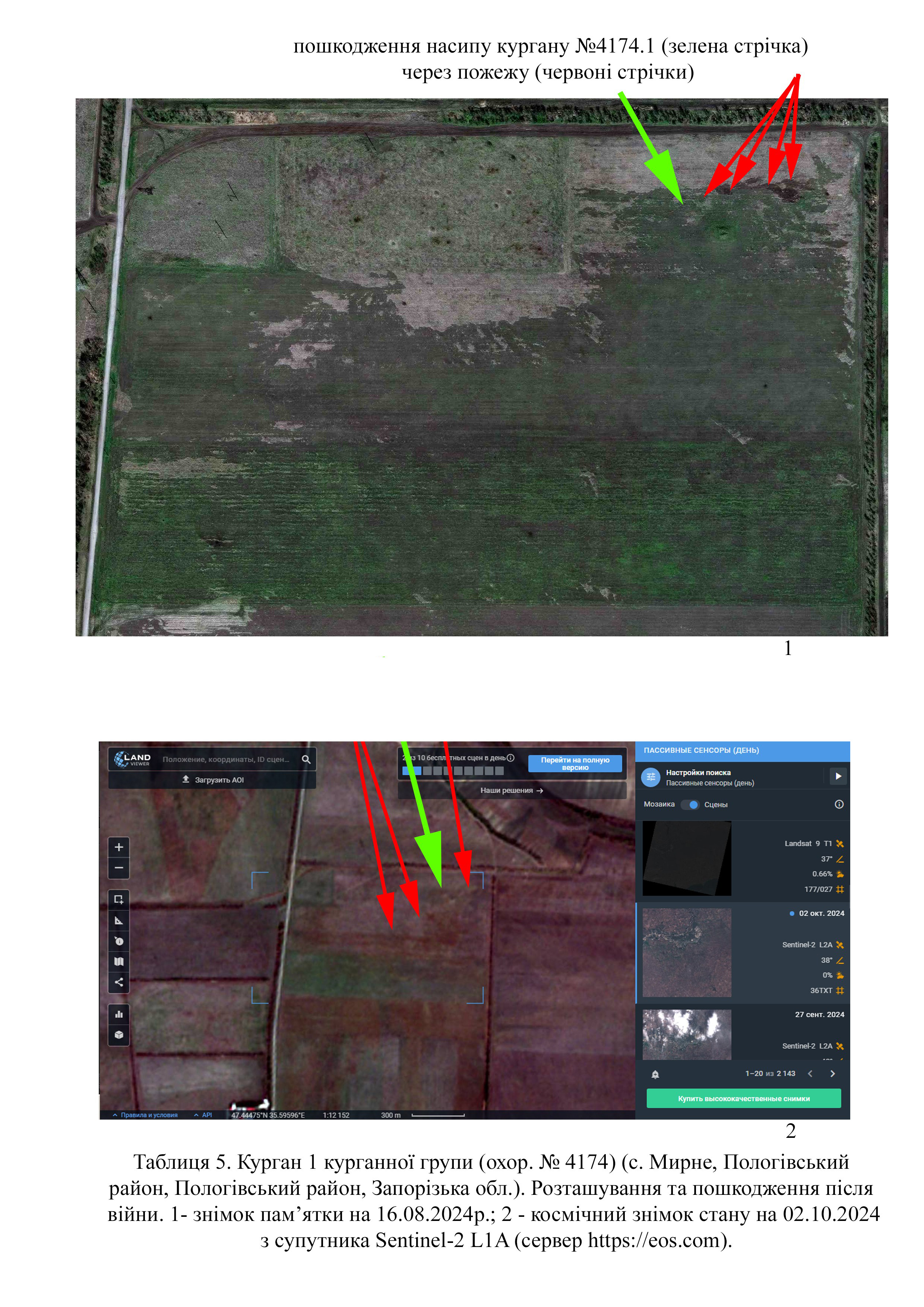
Thanks to the support of UNESCO, we were able to obtain high quality images of the site. They show that on August 16, 2024 the northern part of the field almost completely burnt down. As a result of hostilities, the barrow and the surrounding area were damaged (Tables 5, 1).
Thanks to medium-quality imagery from October 2, 2024 (Sentinel-2 L1A satellite from https://eos.com), it can be established that the barrow only bears signs of new routes (Tables 5, 2).
Gallery
Additional files
Involved persons
- - The construction of defensive installations was authorized by the occupation administration of the Polohy district and the Russian occupiers.
Video gallery
information is clarified