General information
Location
District - Kalmius district
Community - Boykiv community
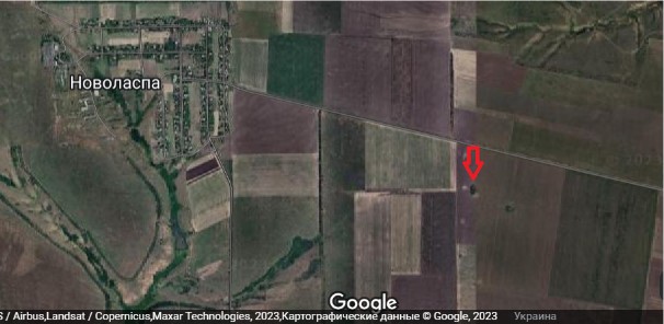
City - 1.5 km. east of the Novolaspa village
Donetsk region
Kind of cultural heritage
ArchaeologicalObject type
СonstructionsResearch zone
Donetsk regionMap
Object history and violation description
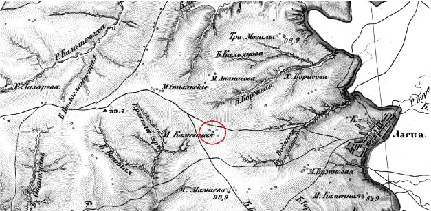
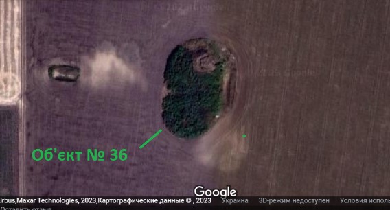
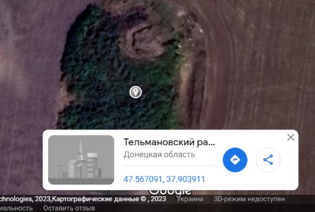
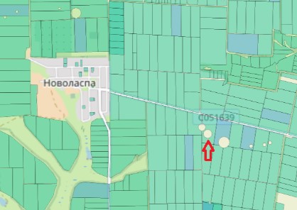
The barrow is 1.5 km east of the development area of Novolaspa village, Boikivske community, Kalmius district. On the 19th-century historical map by Friedrich von Schubert, the barrow is localized as a cluster of four barrows in the middle of the plakor (flat interfluve)* section of the right bank of the Kalmius river, intensively dissected by a system of large gullies. Apparently, one of the largest barrows in the group had a historical name – “Mohyla Kamiana” (“Stone Grave”). According to the Public Cadastral Map of Ukraine, the presence of six barrows of different sizes is currently established within the location (picture No. 5), which is explained by the practice of mapping only the largest barrow embankments. Therefore, it is impossible to determine which of them is the bearer of the historical toponym without conducting additional archival research. The barrow is quite large, somewhat asymmetrical in plane. Its dimensions are 40 x 60 meters. Such a situation may be explained by the long-term impact of tillage, whose direction coincides with the orientation of the long axis of the archaeological complex. 200 meters north of the barrow runs a secondary road that connects Novolaspa village with the main highway Donetsk – Novoazovsk. Apparently, this was the reason why representatives of illegal armed formations of the so-called DPR arranged a system of fortifications near the road, into which site No. 0036 was integrated. The periphery of the barrow is surrounded by caponiers (a fortification structure that allows generating flank or enfilade fire in two opposite directions) (part of which, as of 2021, is plowed). On its top, a gun emplacement has been set up. From the eastern side, the entire length of the massif of the complex has been virtually destroyed by a wide long ditch, whose dimensions, according to modern space images, are 4 x 20 meters.
Digital data carriers with an electronic list of archeological sites of Donetsk region and relevant cartographic materials were removed from the archeology department of the Donetsk Regional Museum of Local Lore by unknown armed persons in the summer of 2014, during the occupation of Donetsk city by Russian hybrid armed formations. As of today, they are officially considered lost. As part of the project on remote monitoring of cultural heritage sites, the damaged archaeological objects have been assigned internal conventional numbers.
* Plakor (from Greek plax – plane, plain) is a flat or slightly wavy part of the basin of a lowland river near the watershed.
Gallery
Additional files
information is clarified
Involved persons
information is clarified
Video gallery
information is clarified
Sources
Links
information is clarified