General information
Location
District - Polohy district
City - Fedorivka village
Kind of cultural heritage
ArchaeologicalObject type
СonstructionsViolation type
information is clarifiedResearch zone
Zaporizhzhia regionMap
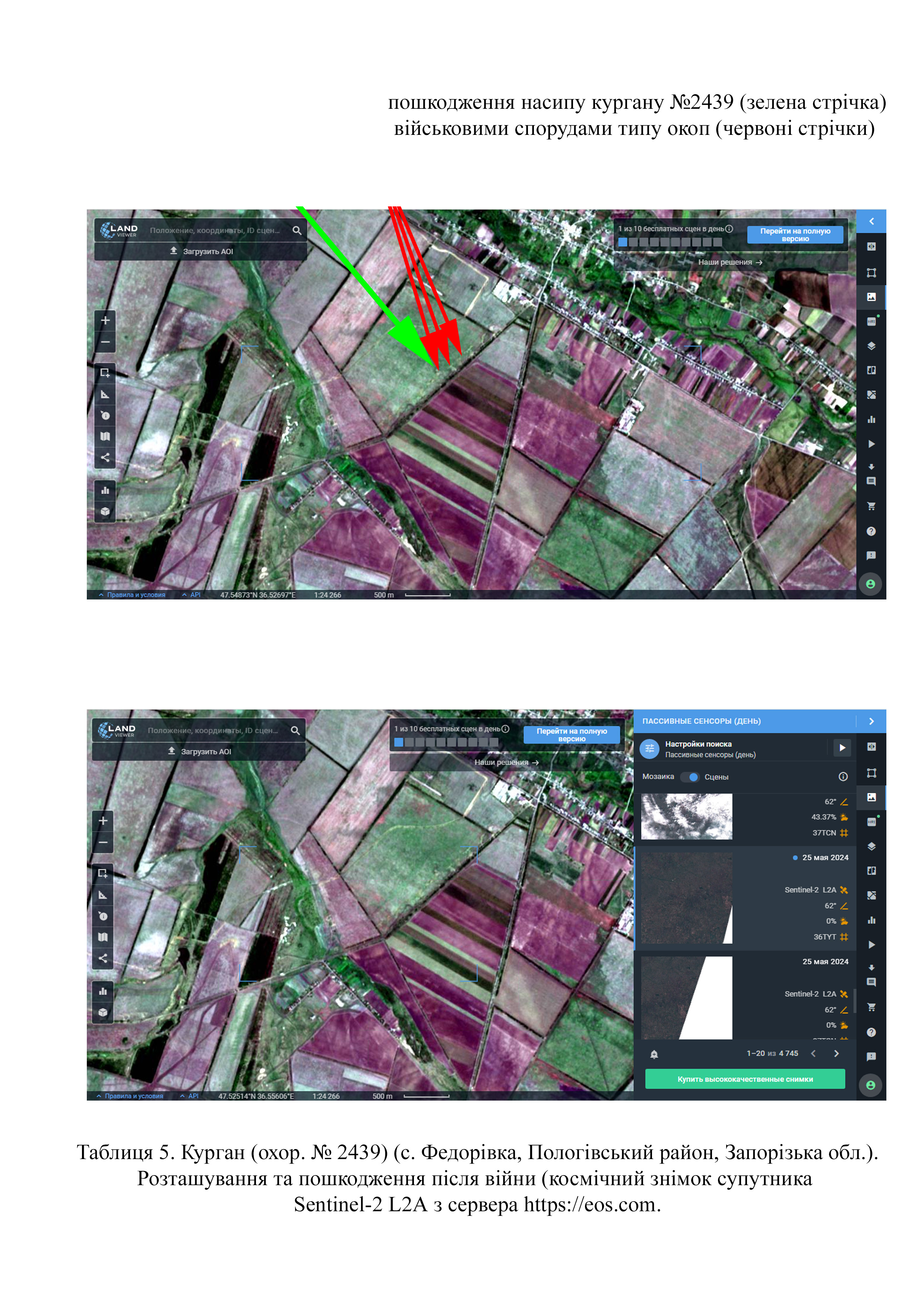
Object history and violation description
The territory of the Velykyi Luh (“Great Meadow”) boasts a huge number of mound necropolises (Table 1). The terms “barrow” or “grave” mean a round or long mound of earth erected over one or more burials. The first barrows emerged in the steppe zone of the Northern Black Sea region in the 4th millennium BC and existed until the 1st half of the 2nd millennium AD. The long-term use of such embankments as necropolises gave rise to barrow groups. The barrows contain layers of several historical eras. Burials carried out at different depths are divided into main and inlet burials. Each time, the barrow was filled in, stone stelae and wooden pillars were installed on its top. The barrow was repeatedly used during trizna – rites related to honoring the souls of buried ancestors.
Archaeological research in the territory of Zaporizhzhia region was carried out in the 1970s and 1980s during the heyday of excavations associated with the growing construction of land amelioration structures. The same period marked the beginning of the inventory of cultural heritage sites.
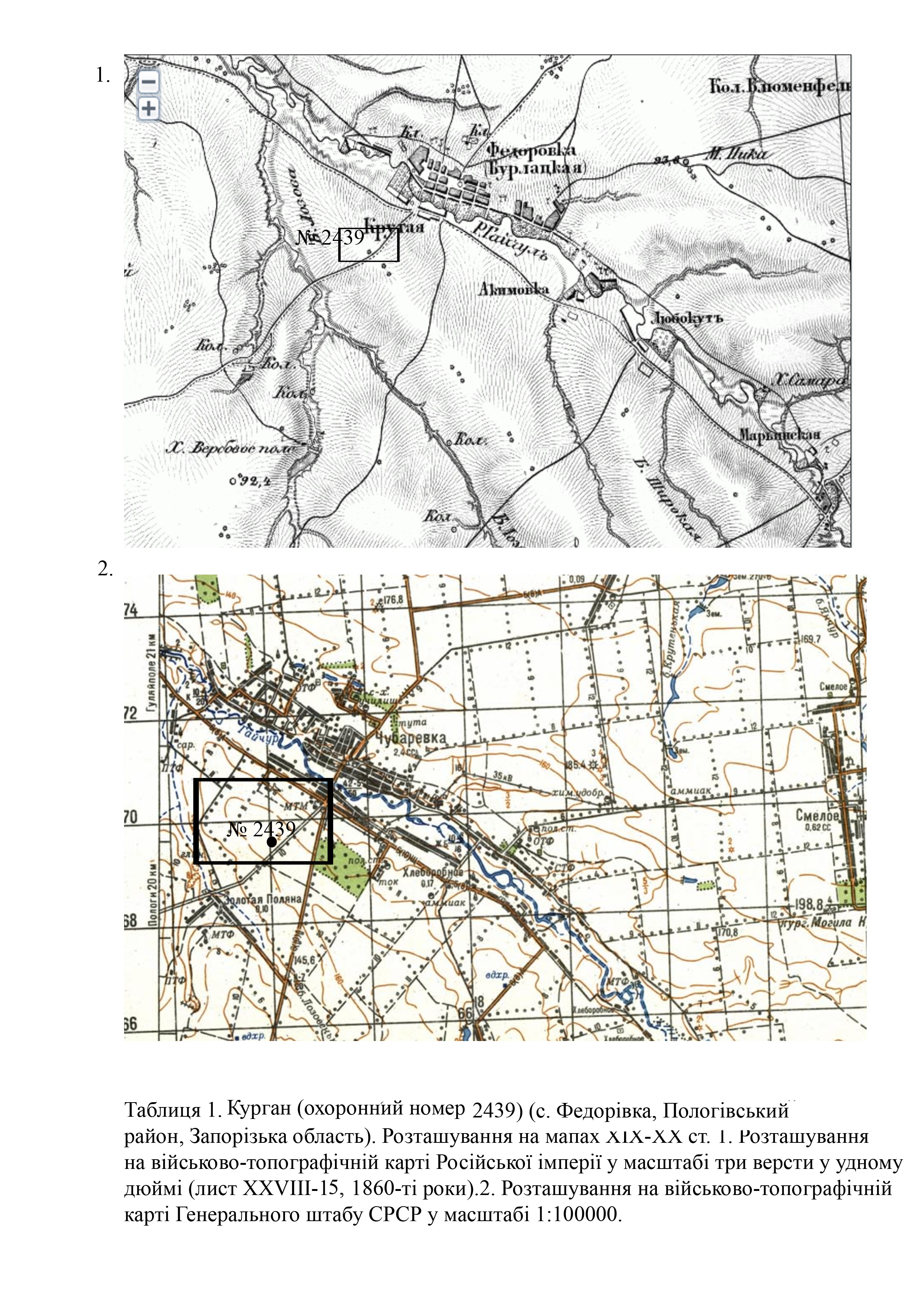
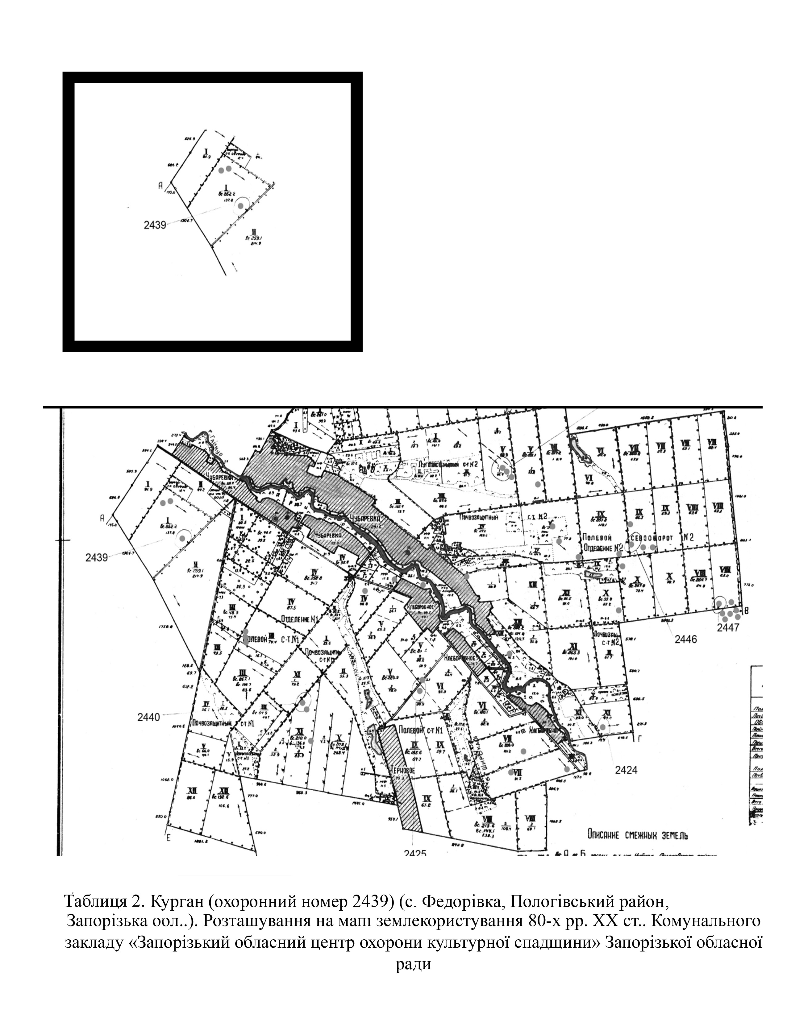
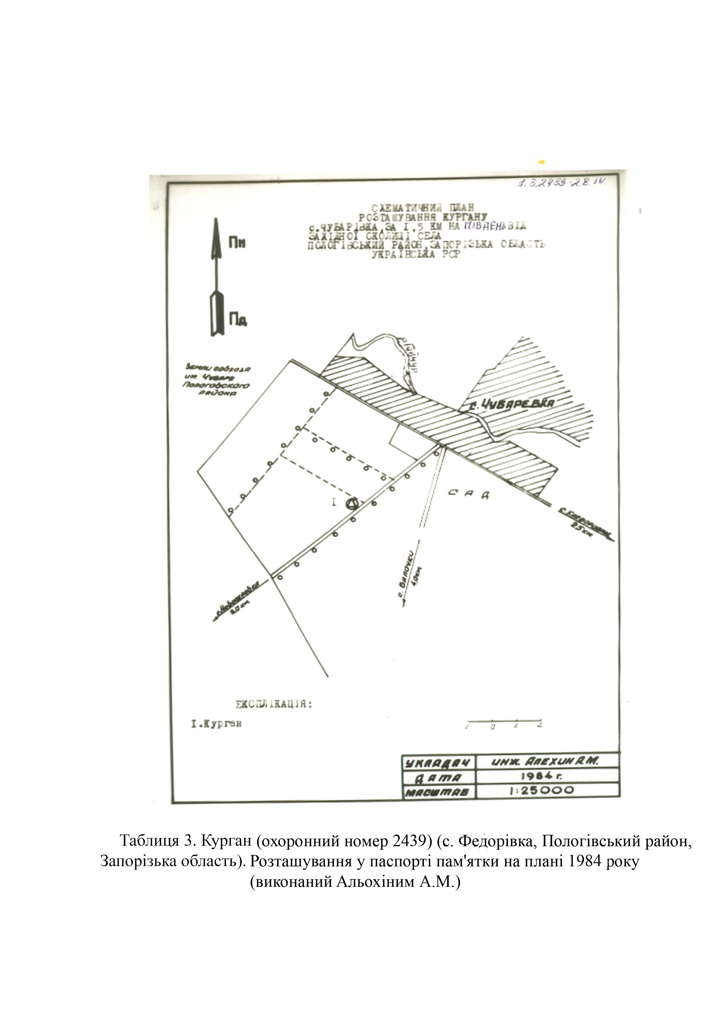
The barrow (protection No. 2439) was first examined by A. Alokhin, an employee of the Zaporizhzhia Regional Museum of Local Lore, in 1984 (Tables 2, 3)
In 1985, the executive committee of the Zaporizhzhia Regional Council of People's Deputies made a decision to include the barrow under protection number No. 2439 in the list of archaeological sites of local importance and approved its protection zone (No. 434 of November 26, 1985).
The barrow meets the criteria of authenticity and is also associated with historical events, beliefs and the development of culture in this area.
According to the certificate, the barrow is of round shape. It is located on the plain plateau on the left bank of the Haichur river. The barrow is situated 122 meters to the northwest of the road connecting Fedorivka village and Zolota Poliana village (Table 2; 3). Mound parameters are as follows: height – 1.5 meters; diameter – 57 meters.
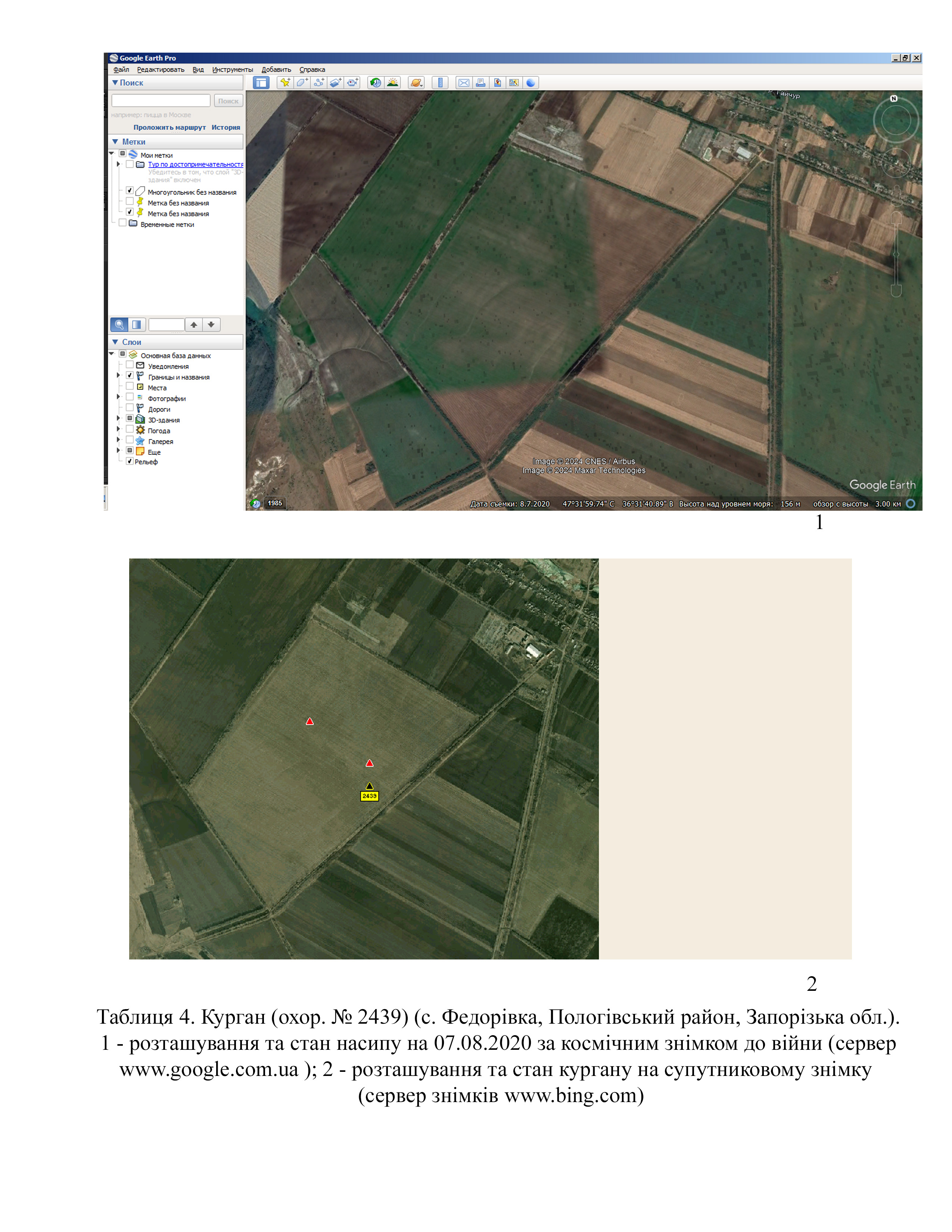
In the space images from August 7, 2020 from the Google Earth Pro server (https://google-earth-pro), it is clearly visible that the barrow had no significant damage (Table 4).
According to the map of the war chronology, during the southern offensive, in March 2022, Polohy district was occupied by Russian troops (Deep State map https://deepstatemap.live).
During 2022 and 2023, units of the 38th and 69th Motorized Rifle Brigades of Russia’s Armed Forces and the 71st Motorized Rifle Regiment were stationed on the outskirts of the village (data from Deep State Map https://deepstatemap.live).
Thanks to high-quality images dated May 25, 2024 from the Sentinel-2 L2A satellite (server https://eos.com), it can be established that barrow 2439 was damaged by military installations (trenches) (Table 5).
The construction of defensive installations was authorized by the occupation administration of Polohy district.
Gallery

Additional files
Involved persons
- - The occupation administration of Polohy district.
- - The military occupiers
Video gallery
information is clarified