General information
Location
District - Vasylivka district
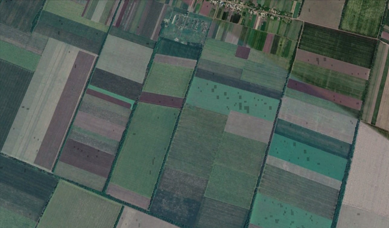
City - 1.1 km to the south from the southern outskirts of Trudoliubymivka village
Zaporizhzhia region
Kind of cultural heritage
ArchaeologicalObject type
СonstructionsViolation type
information is clarifiedResearch zone
Zaporizhzhia regionMap
Object history and violation description
The territory of the steppe boasts a huge number of mound necropolises (Table 1). The terms “barrow” or “grave” mean a round or long mound of earth erected over one or more burials. The first barrows emerged in the steppe zone of the Northern Black Sea region in the 4th millennium BC and existed until the 1st half of the 2nd millennium AD. The long-term use of such embankments as necropolises gave rise to barrow groups. The barrows contain layers of several historical eras. Burials carried out at different depths are divided into main and inlet burials. Each time, the barrow was filled in, stone stelae and wooden pillars were installed on its top. The barrow was repeatedly used during trizna – rites related to honoring the souls of buried ancestors.
Archaeological research in the territory of Zaporizhzhia region was carried out in the 1970s and 1980s during the heyday of excavations associated with the growing construction of land amelioration structures (Toshchev, Yelnikov, Drovosekova, Drevnosti Zaporozhskogo kraya, 2003. 49-55). The same period marked the beginning of the inventory of cultural heritage sites.
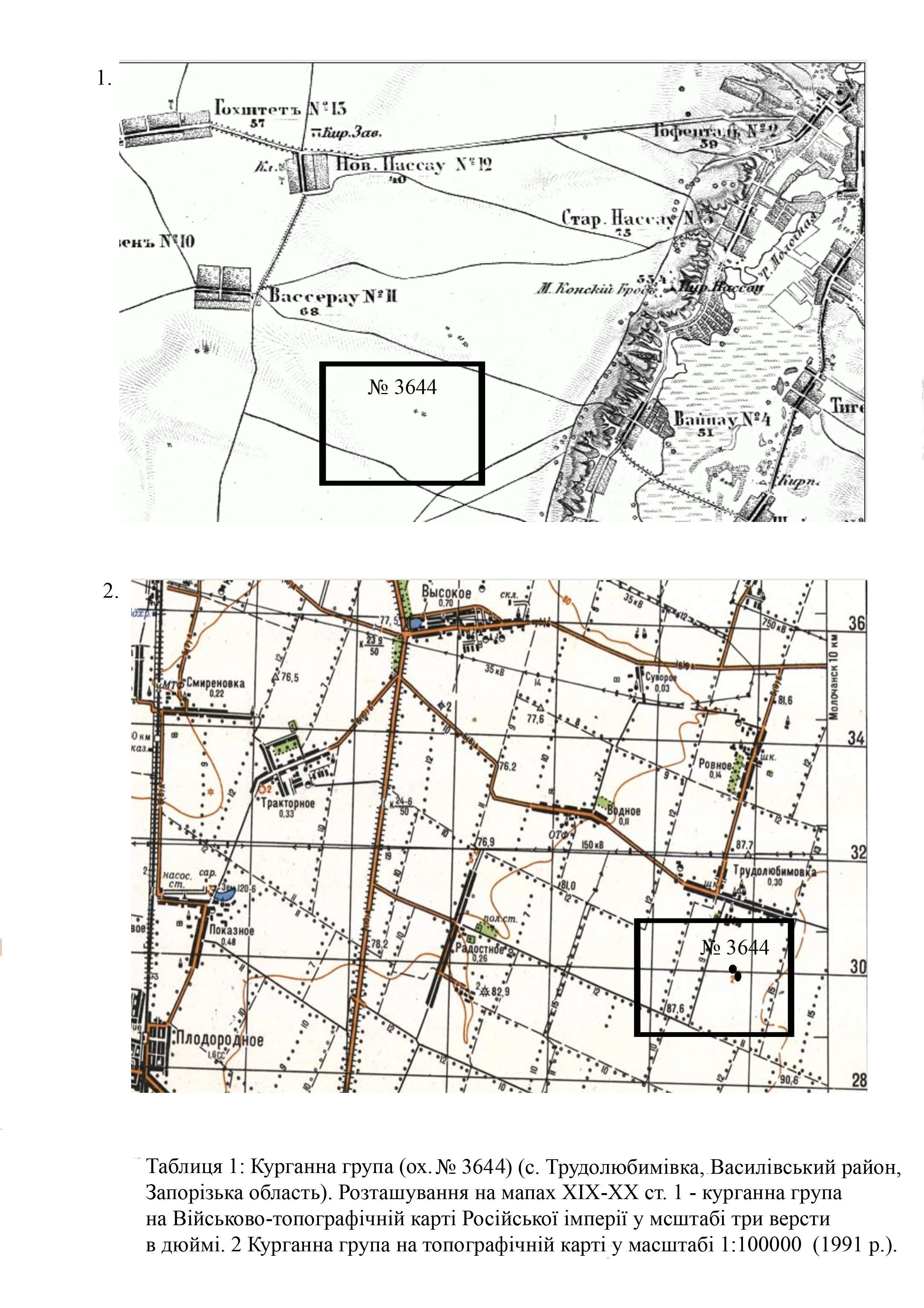
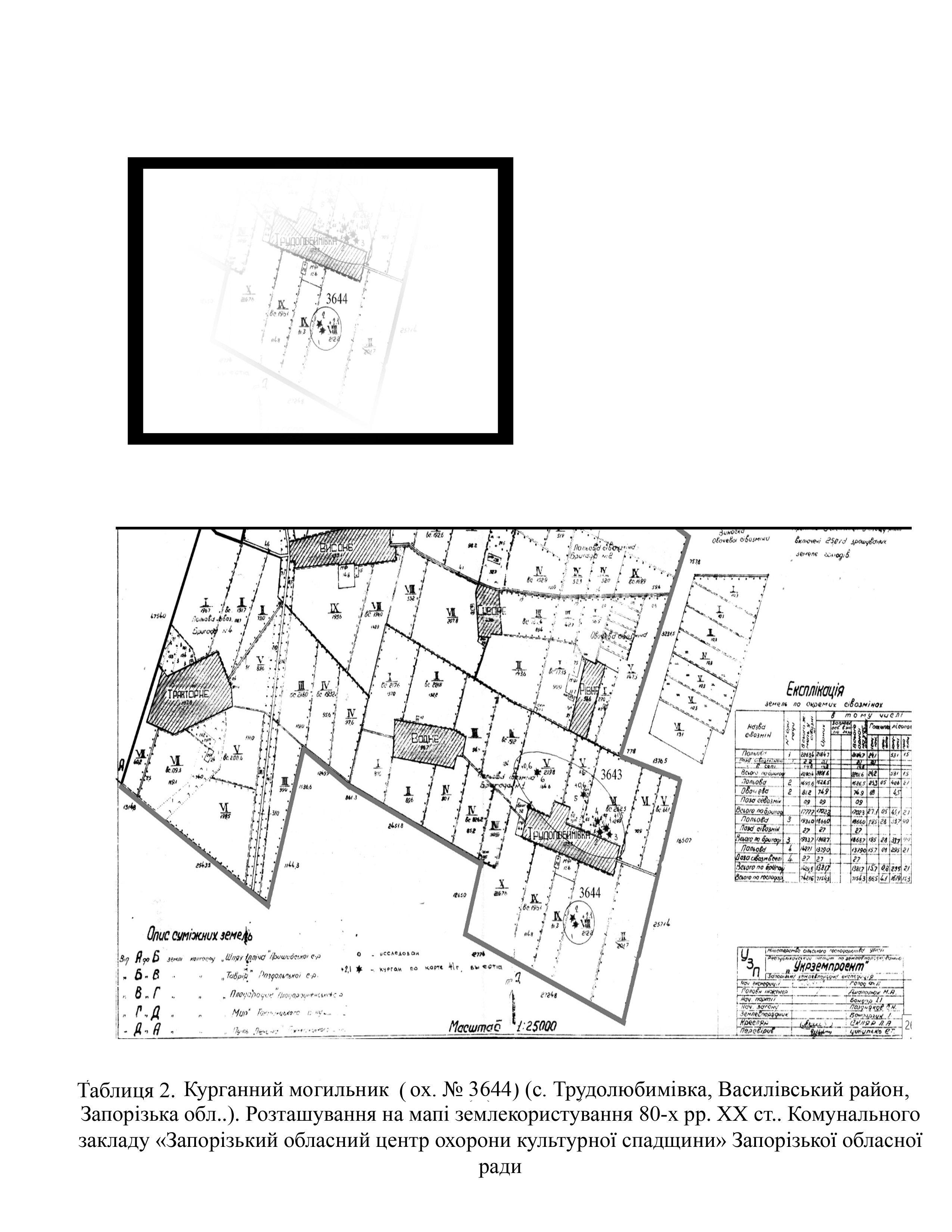
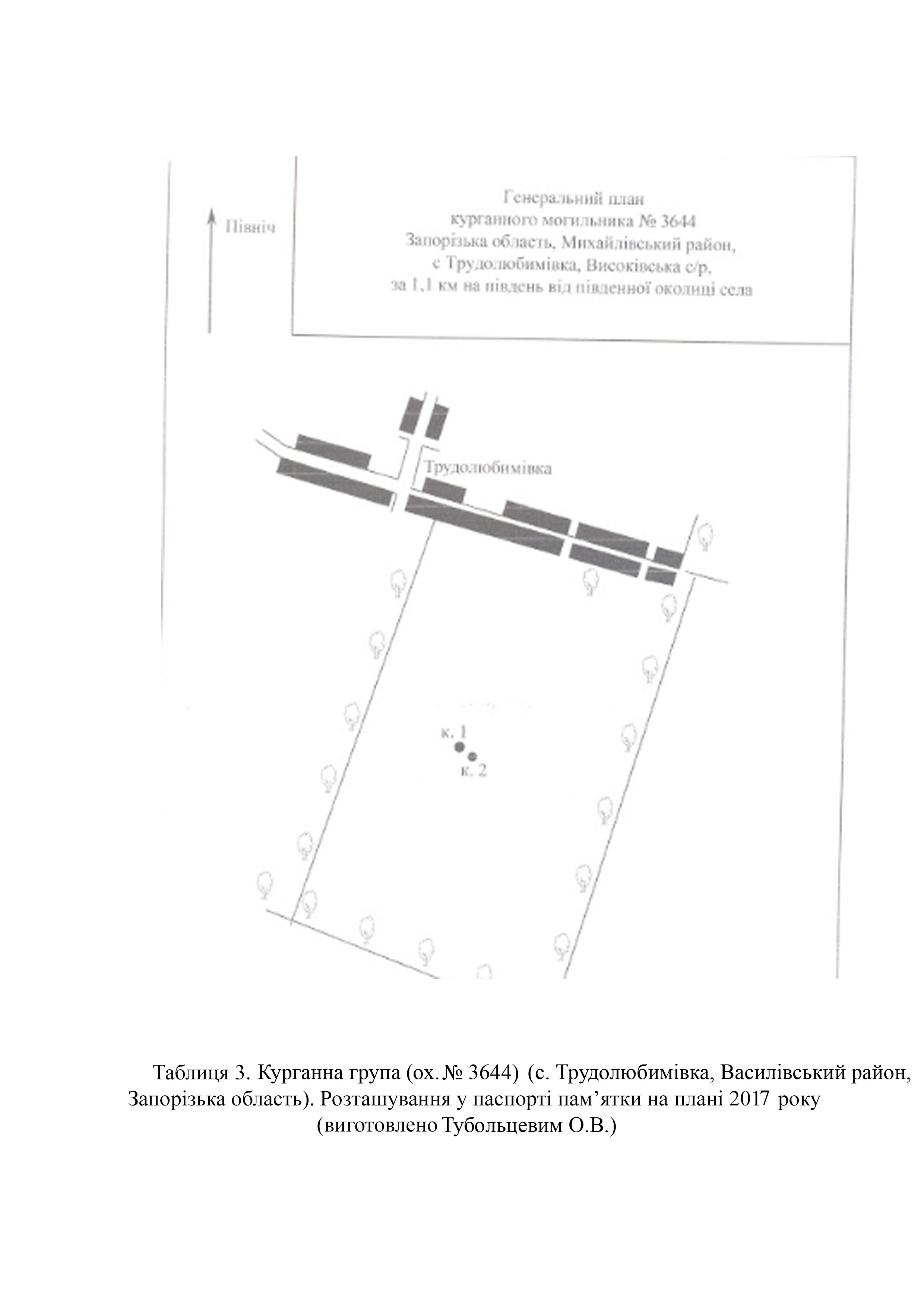
The barrow group (protection No. 3644) was first examined by the Zaporizhzhia Archaeological Expedition of the Institute of Archaeology of the Academy of Sciences of the Ukrainian SSR, led by V. Otroshchenko, in 1987. In 2006, the barrow group was further examined by O. Tuboltsev, a senior research fellow of the Khortytsia National Preserve and head of the New Archaeological School NGO, during the inventory of sites in Mykhailivka district, Zaporizhzhia region (Tables 2, 3)
In 1991, the executive committee of the Zaporizhzhia Regional Council of People's Deputies made a decision to include barrow group No. 3644 in the list of archaeological sites of local importance and approved its protection zone (No. 87 of April 3, 1991).
The barrow group meets the criteria of authenticity and is also associated with historical events, beliefs and the development of culture in this area.
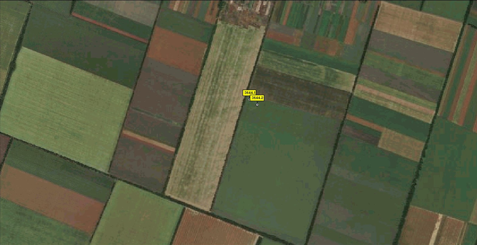
According to the certificate, the site consists of two barrows with mounds of a round shape. The group is located on the high terrace of the right bank of the Molochna river (Tables 2; 3). Mound parameters are as follows:
Barrow No. 1: height – 0.8 meters; diameter – 60.5 m;
Barrow No. 2: height – 1.0 meters; diameter – 40 meters.
In the space images from June 4, 2020 from the Google Earth Pro server (https://google-earth-pro), it is clearly visible that the mounds had no significant damage (Table 4).
According to the map of the war chronology, during the southern offensive, in March 2022, Mykhailivka urban-type settlement was occupied by Russian troops (Chronology of the war by the Current Time agency https://www.currenttime.tv/a/32202314.html; Deep State map https://deepstatemap.live).
In 2022 and 2023, units of the 45th Separate Special Purpose Brigade of the Russian army and the 125th Regiment of the so-called DPR were stationed on the ouskirts (Deep State map https://deepstatemap.live).
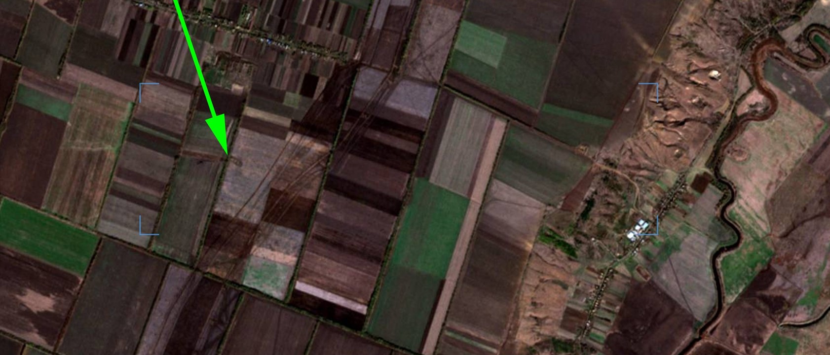
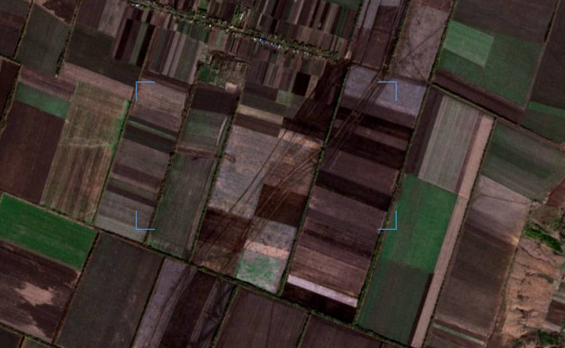
Thanks to high-quality images, it has been established that part of the hemline of barrows 3644.1 and 3644.2 was destroyed by a ditch and a trench dug in this area (Table 5).
Gallery
Additional files
Involved persons
- - The construction of defensive installations was authorized by the occupation administration of Trudoliubymivka village
- - The military occupiers
Video gallery
information is clarified