General information
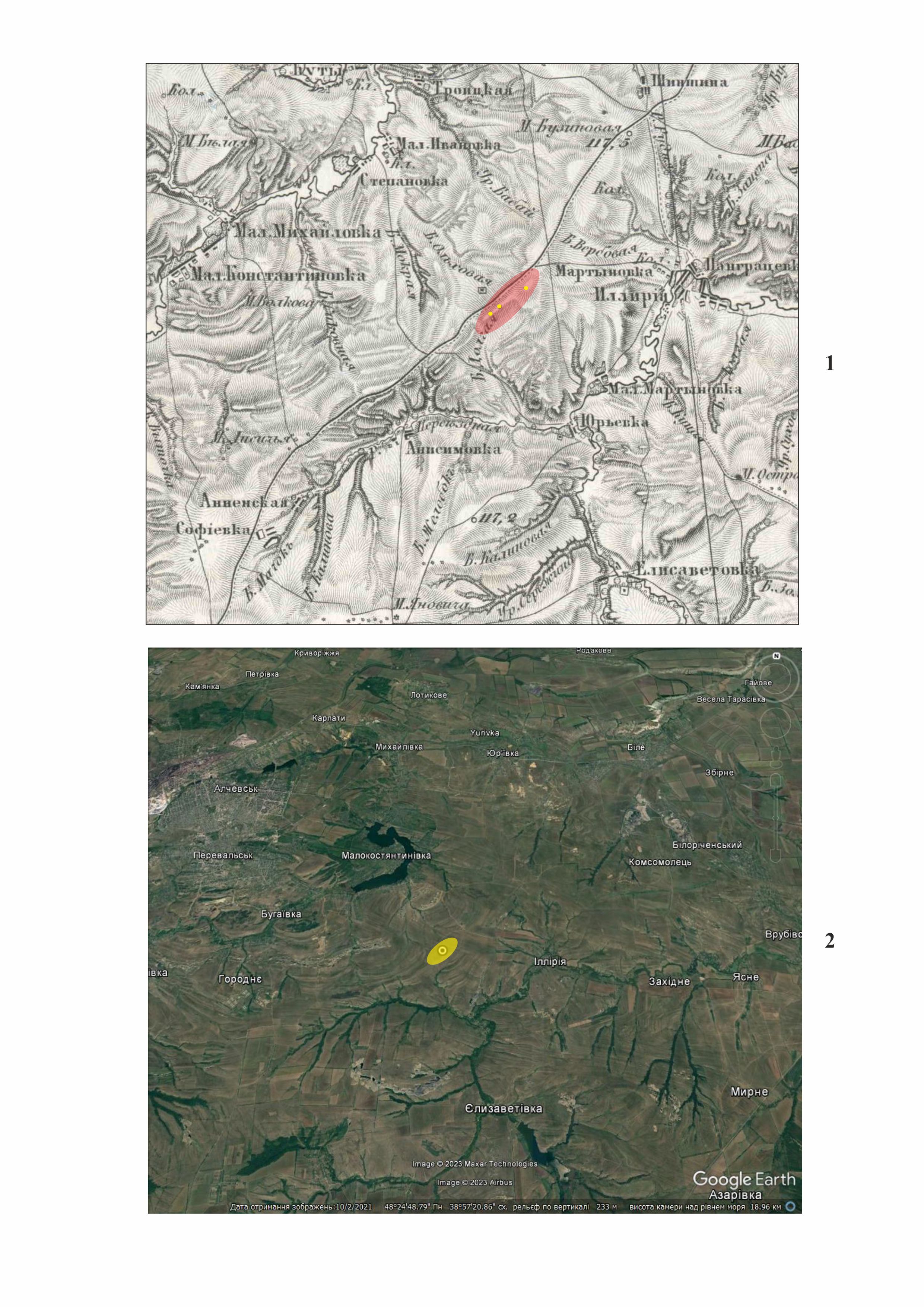
Location
City - on the border of Alchevsk and Luhansk districts (according to the new administrative division; occupied territory).
Kind of cultural heritage
ArchaeologicalObject type
ComplexesResearch zone
Luhansk regionMap
Object history and violation description
Status of the barrow: a newly discovered site, not registered.
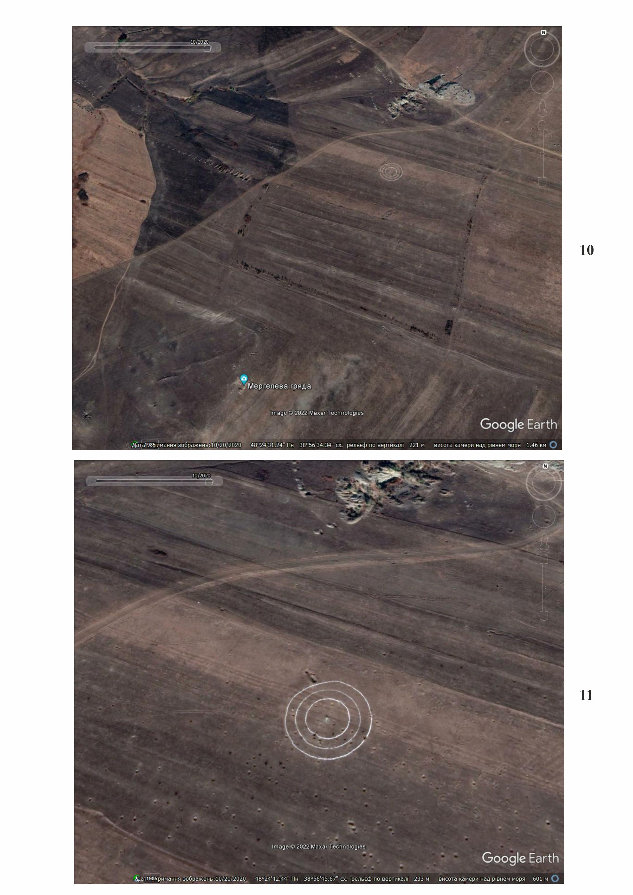
Location. The ridge includes four barrows from 1.3 to 2 meters high. However, the map from the second half of the 19th century by Friedrich von Schubert depicts only three barrows.
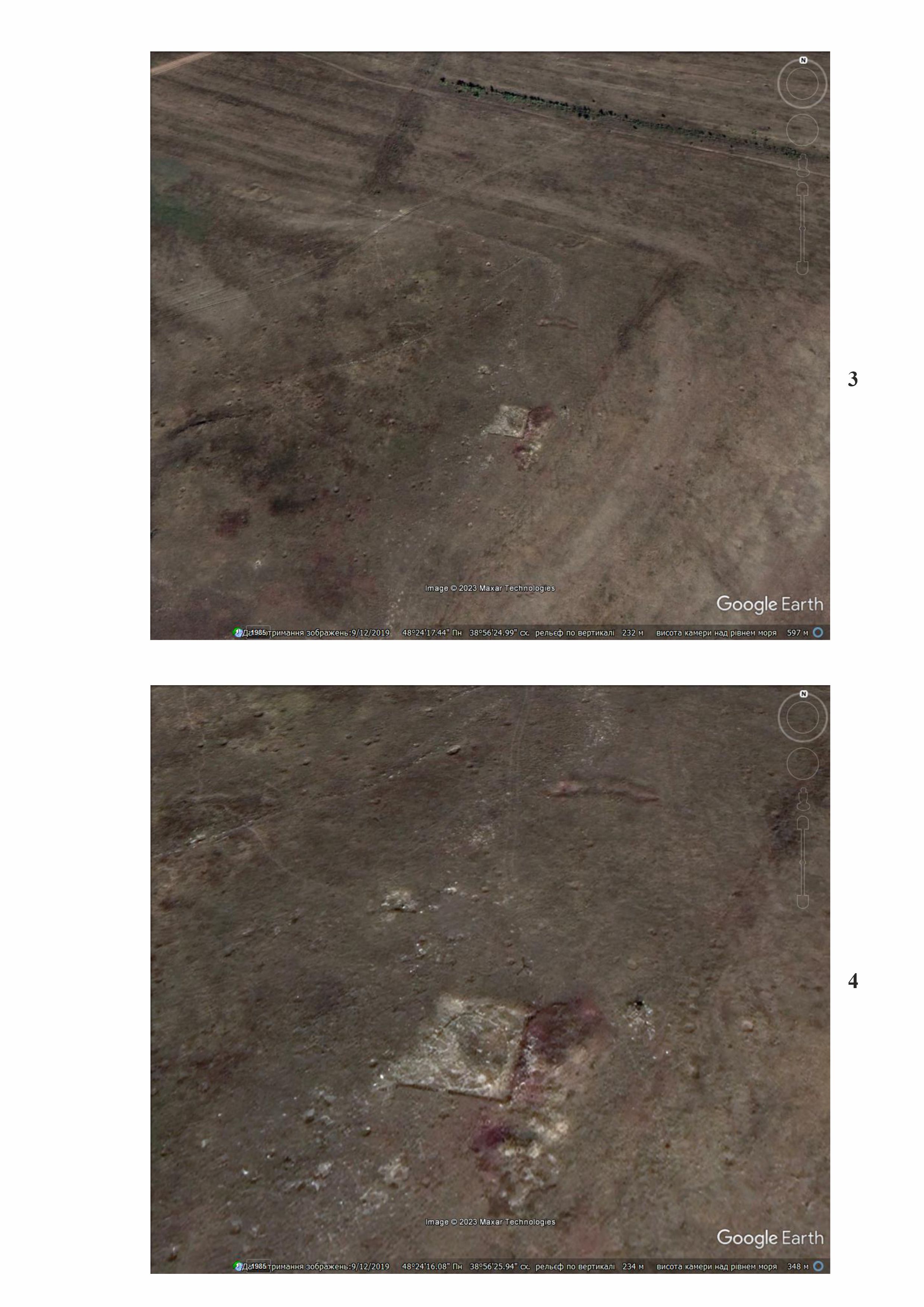
Research history. The complex was discovered by the historical and geographical expedition of the Alchevsk Archeology Fans Club in 2004. In 2005, Doctor of History V. Klochko from the Kyiv-based Science and Research Institute for Monument Preservation Studies led excavations at barrows 2 and 4 and the so-called Ruslan's Tower, named after one of the participants of the expedition, Ruslan Osadchyi; these excavations lasted for four seasons. Schoolchildren from schools of Alchevsk and students from the University of Gdansk also took part in the expedition under the guidance of K. Sliusarska. The expedition discovered a well-preserved cromlech and burials of the Catacomb and Zrubna cultures of the Middle and Late Bronze Age1. To secure special status for his research, V. Klochko spread information that the entire area around the barrows is man-made and viewed the geological features of the area as stone structures. According to the geologists and archaeologists who spoke at a scientific conference in Luhansk in late 2007, there were no artificial structures on the Marl Ridge, apart from ordinary barrows1. However, considering the unique natural landscape and the presence of two more unexplored barrows, this area has always attracted tourists and connoisseurs of local lore. Taking into account the fact that V. Klochko's expedition was financed from the budget of the Luhansk Regional State Administration, the Department of Culture was developing a tourist route until 2014. To visualize the ancient burial object, the structural elements of barrow 4 were left unconserved, which is clearly visible in satellite images (3, 4). It should also be said that, to the east of the archaeological complex between the villages of Illiriia and Zahidne, the Illirian general zoological reserve of local importance is located (created by the decision of the Luhansk Regional Council of People's Deputies No. 4/19 of December 15, 1998). Its total area is 3074.5708 hectares.
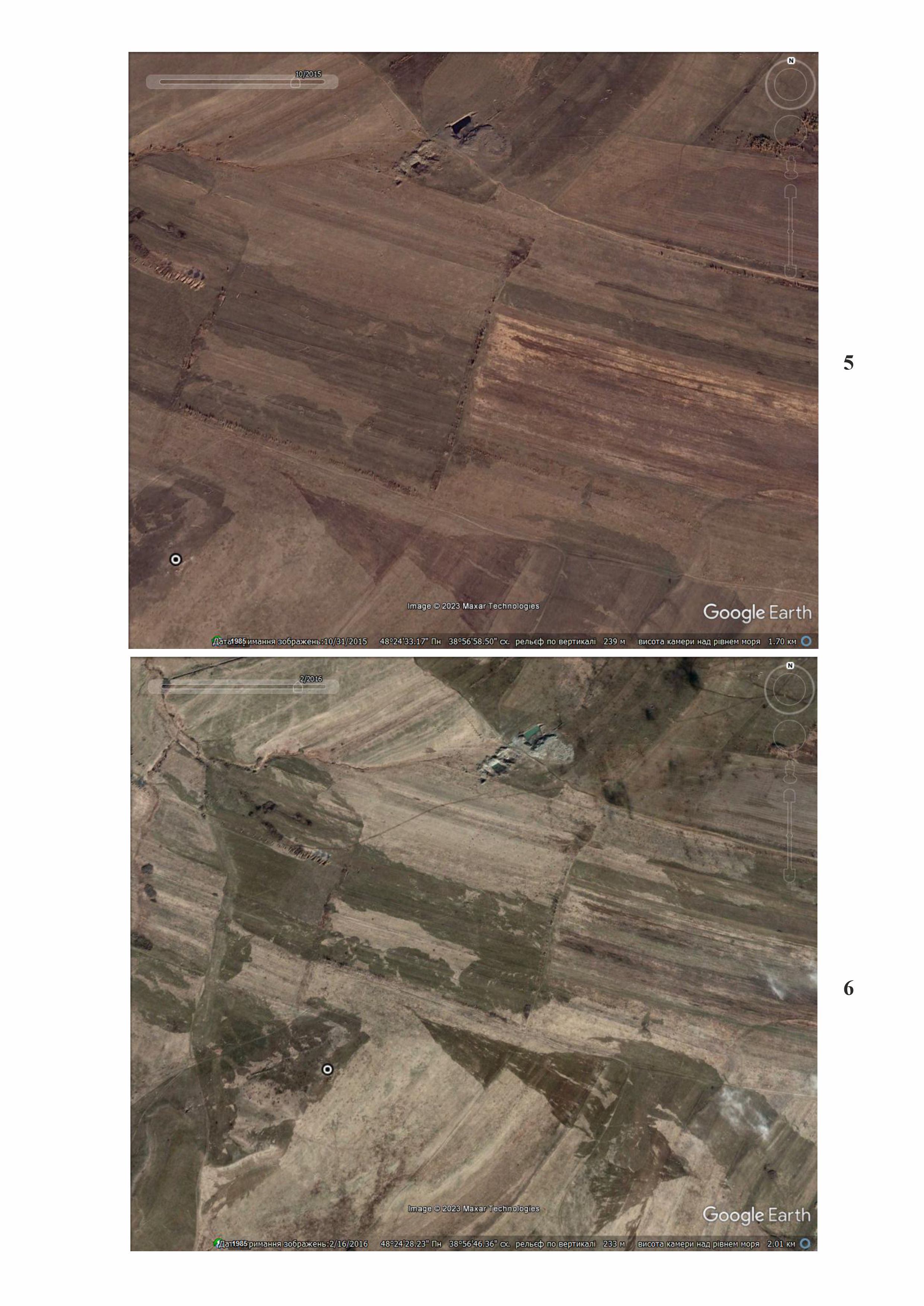
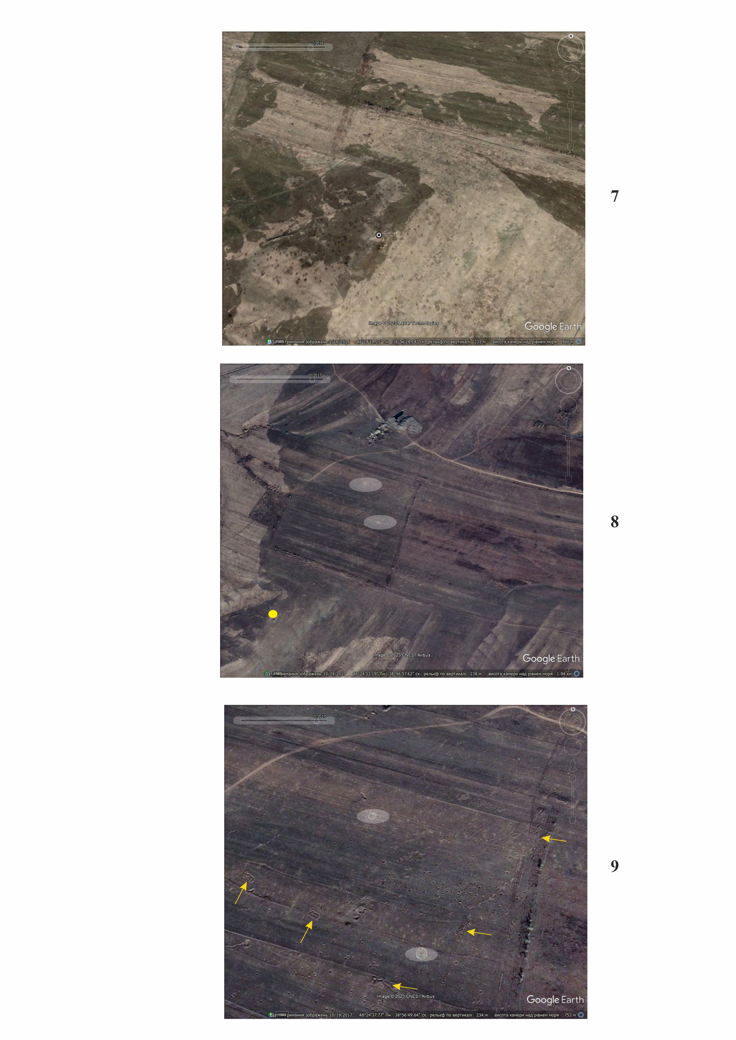
Occupation of Luhansk region. Since 2014, this part of Luhansk region has been occupied. As of October 2015, the area around the site had no signs of damage (5). But already in the next image, which dates from February 2016, one can see numerous traces of explosions directly at the excavation site, where ancient stone structures were open for viewing, and around it (6,7). The territory of the archaeological complex began to be used as an artillery firing range. In the image dated October 19, 2017, one can see ground targets located 736 and 885 meters northeast of the complex; just 75 and 155 meters northeast of the barrow, four trenches are visible (8, 9, 10, 11).
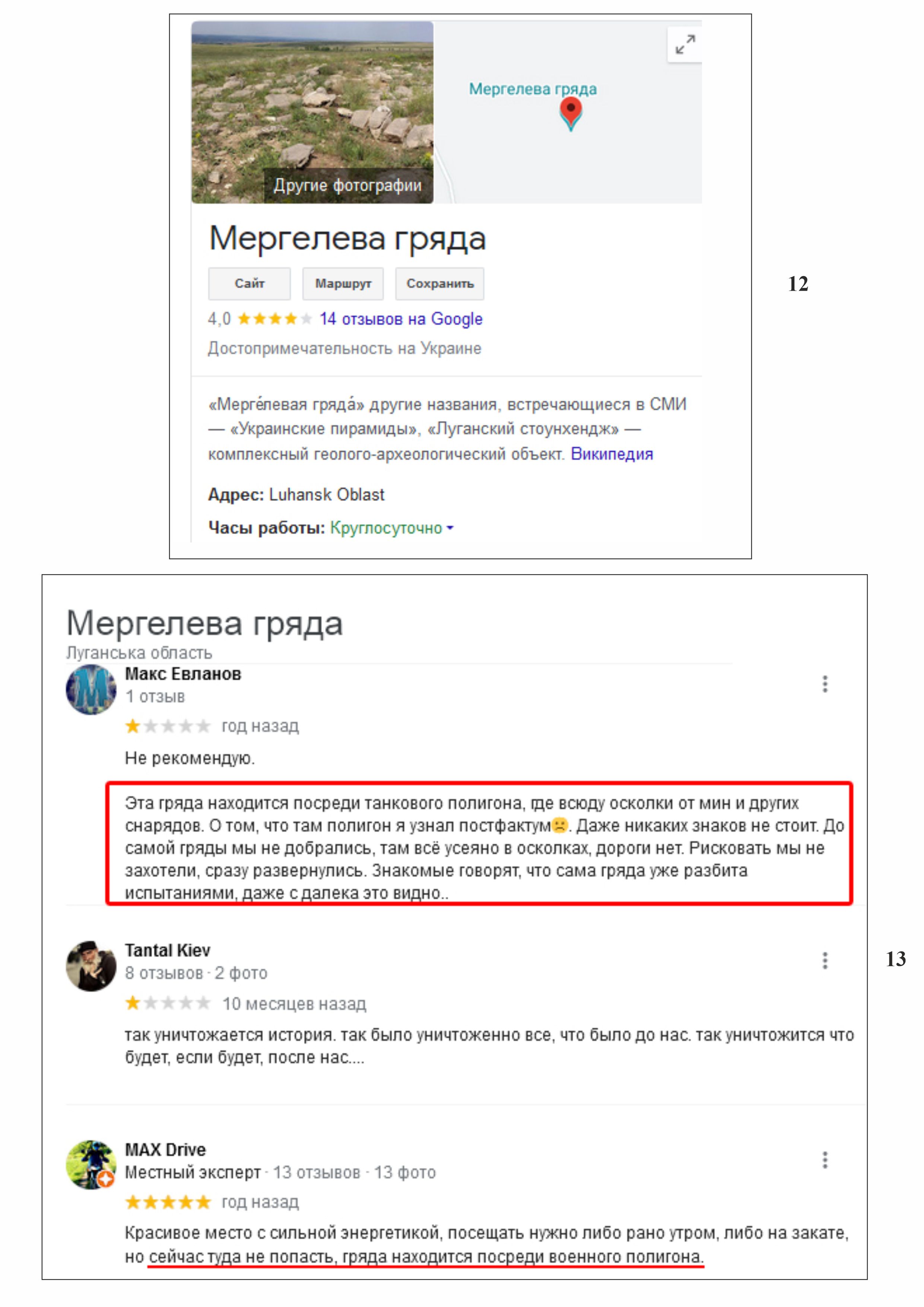
In one of the posts about the Marl Ridge in 2020, Maksym Yevlanov left a comment: “I do not recommend visiting it. This ridge is in the middle of a tank training ground, where fragments from mines and other projectiles are scattered everywhere. It was not until later that I found out about it. There are no warning signs. We didn't get to the ridge itself, everything is strewn with fragments, there is no road. We didn't want to risk it, so we immediately turned around. Acquaintances of mine say that the ridge itself has already been destroyed during trainings, which is visible even from afar…” (12,13).
Thus, the unique archaeological and natural complex of the Donets ridge called “Marl Ridge” was severely damaged due to the installation of a training ground of the Russian occupying forces on it.
As of 2014, the landscape around the site was undergoing human-induced changes due to illegal coal mining (so-called kopanky – “pits”).
Gallery


Additional files
information is clarified
Involved persons
information is clarified
Video gallery
information is clarified
Sources
Links
- Marl ridge (archaeological site)
- Klochko V. I., Klochko L. S., Slyusarsʹka K., Osadchyi R. M., Paramonov V. O. 2009. Zvit pro doslidzhennia kompleksnoi arkheolohichnoi pamiatky “Merheleva hriada” u 2005–2008 rokakh. Scientific Archive of the Institute of Archaeology of the National Academy of Sciences of Ukraine, 2005-2008/72, f.e. 29565.