General information
Location
District - Luhansk district
Community - Luhansk city community
City - Zhovte village
Kind of cultural heritage
ArchaeologicalObject type
СonstructionsViolation type
Use for military purposesResearch zone
Luhansk regionMap
Object history and violation description
Date of creation of the barrow group: Bronze Age – Middle Ages;
Status of the site: not on the State Register.
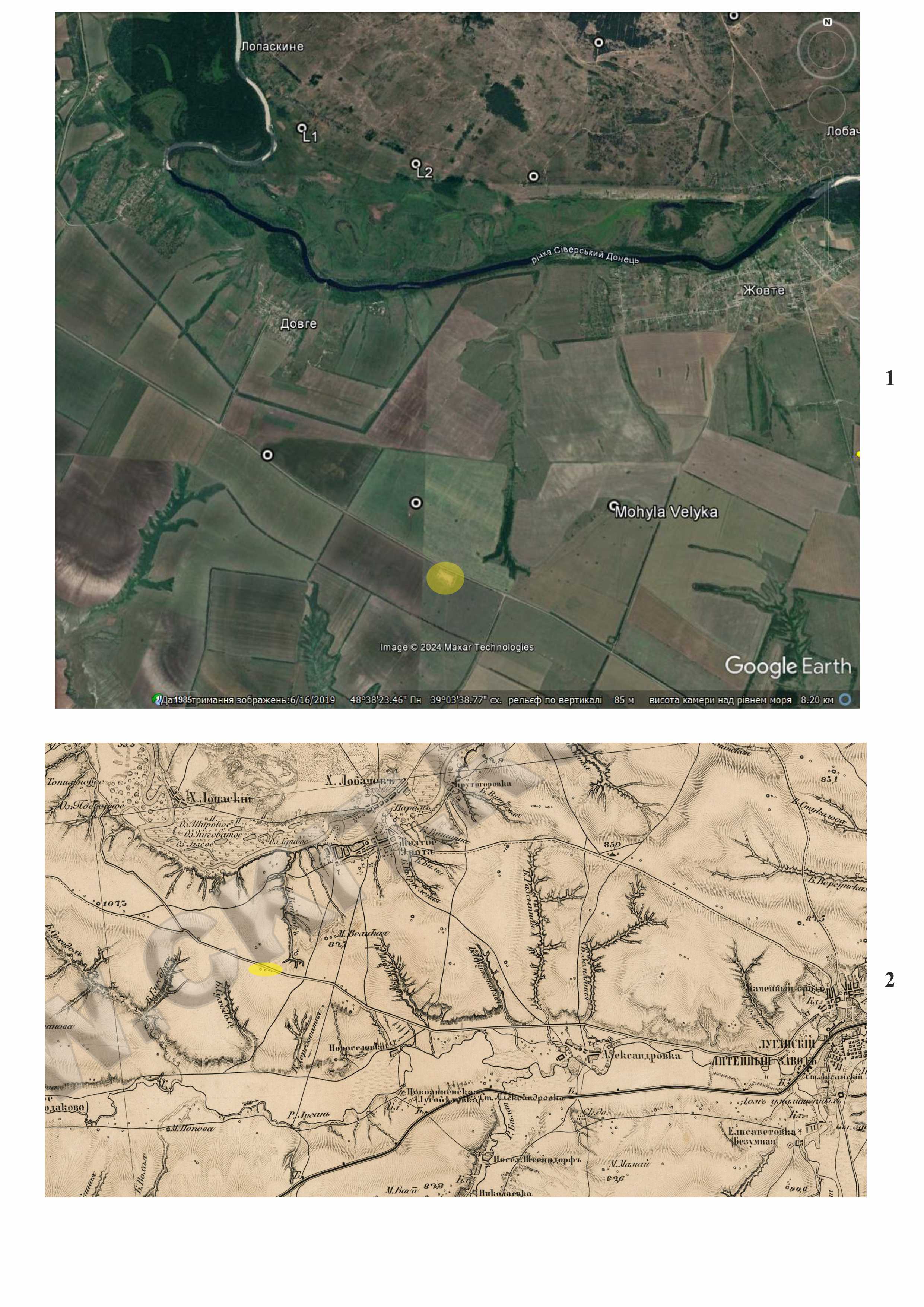
Location. The barrow is located in the watershed between the Siversky Donets and Luhan rivers, near the regional road R-66 (Domino — Oleksandrivka — Luhansk), 3.49 km southwest of Zhovte village and 18.87 km west-northwest from the central part of Luhansk city (1). Next to the barrow, on the southeastern side, there is a reclamation basin. The western part of the barrow borders an arable field. Images show that during plowing, agricultural machinery bypassed the mound.
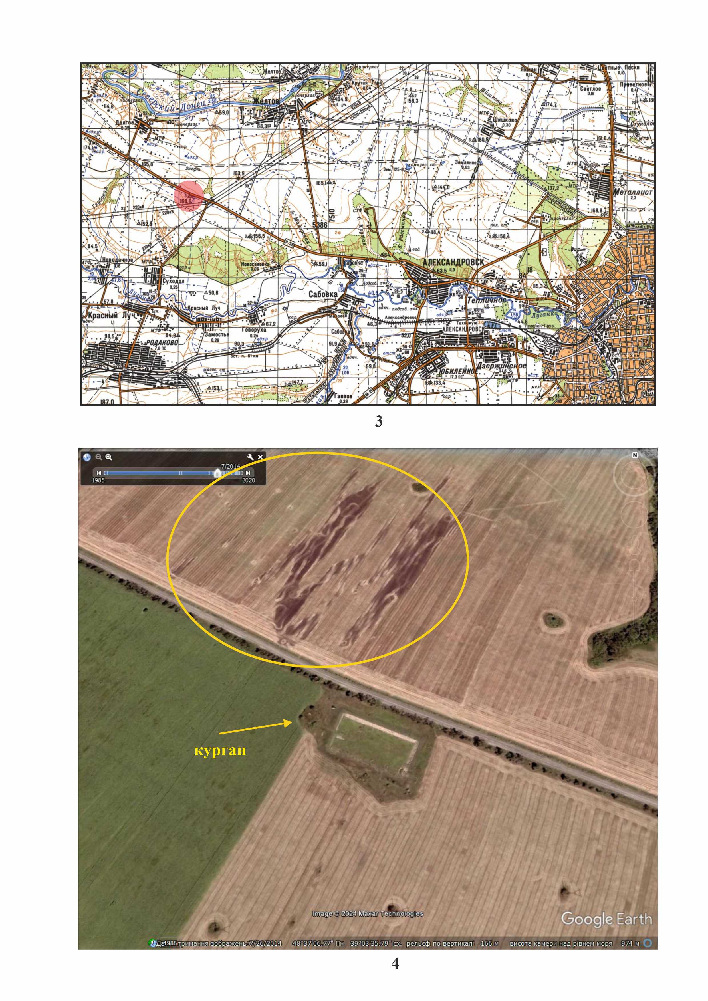
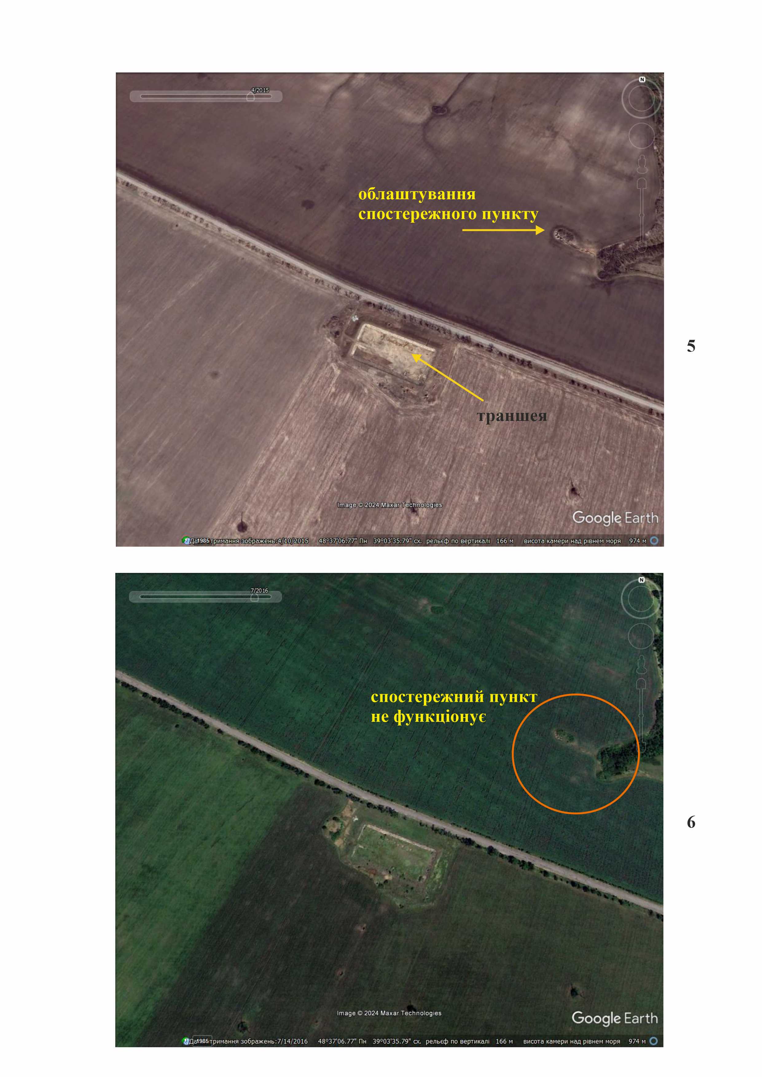
Brief historical reference. On the map of the late 19th century, four barrow are marked, elongated along the northwest-southeast line (2). During the construction of the reclamation basin, three barrows may have been destroyed. The map of the General Staff of the USSR also has the mark “barrow” and number 3, which corresponds to its height (3). The elevation of the area is 156.5 meters above sea level. The surface of the mound was sod and covered with bushes.
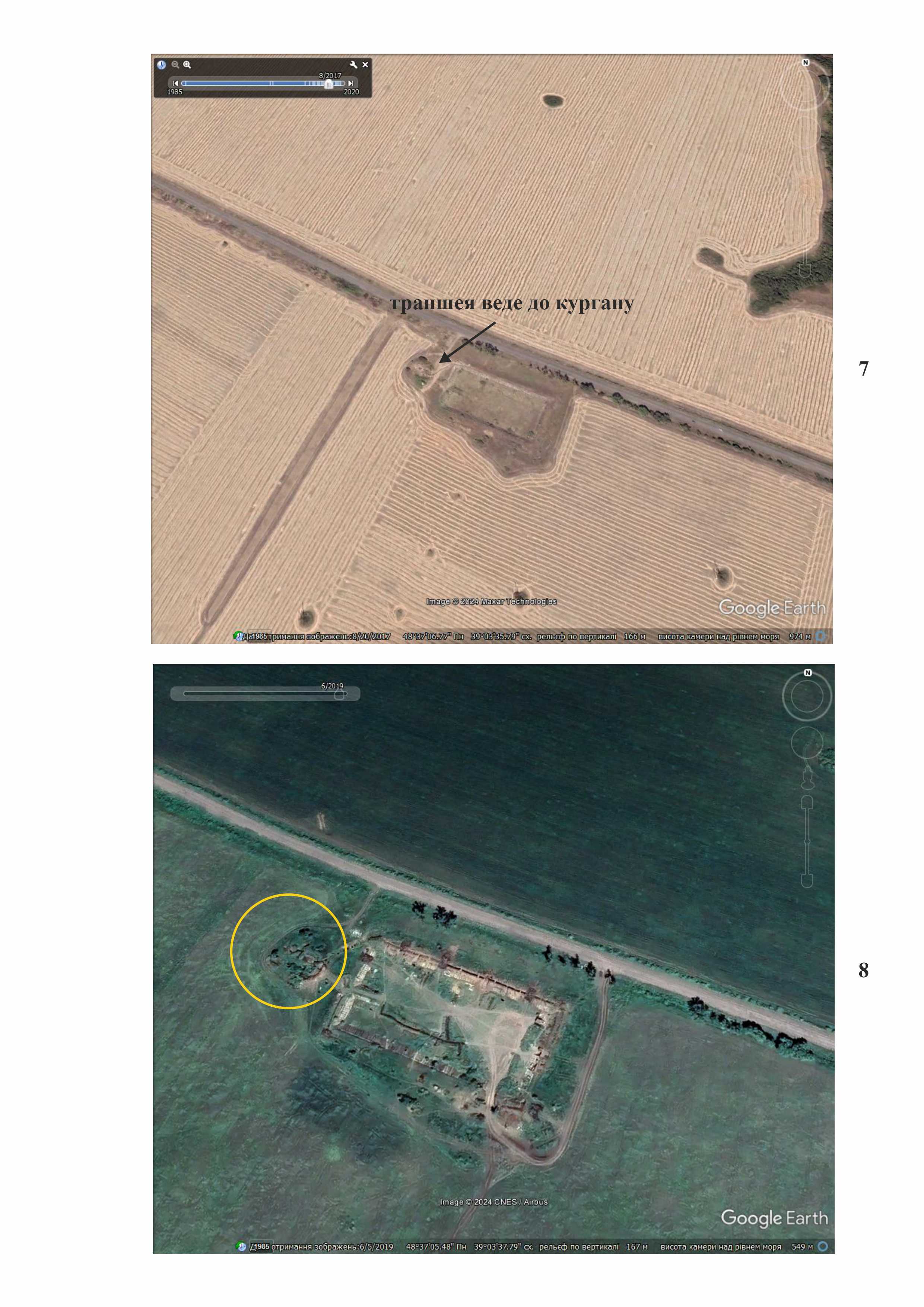
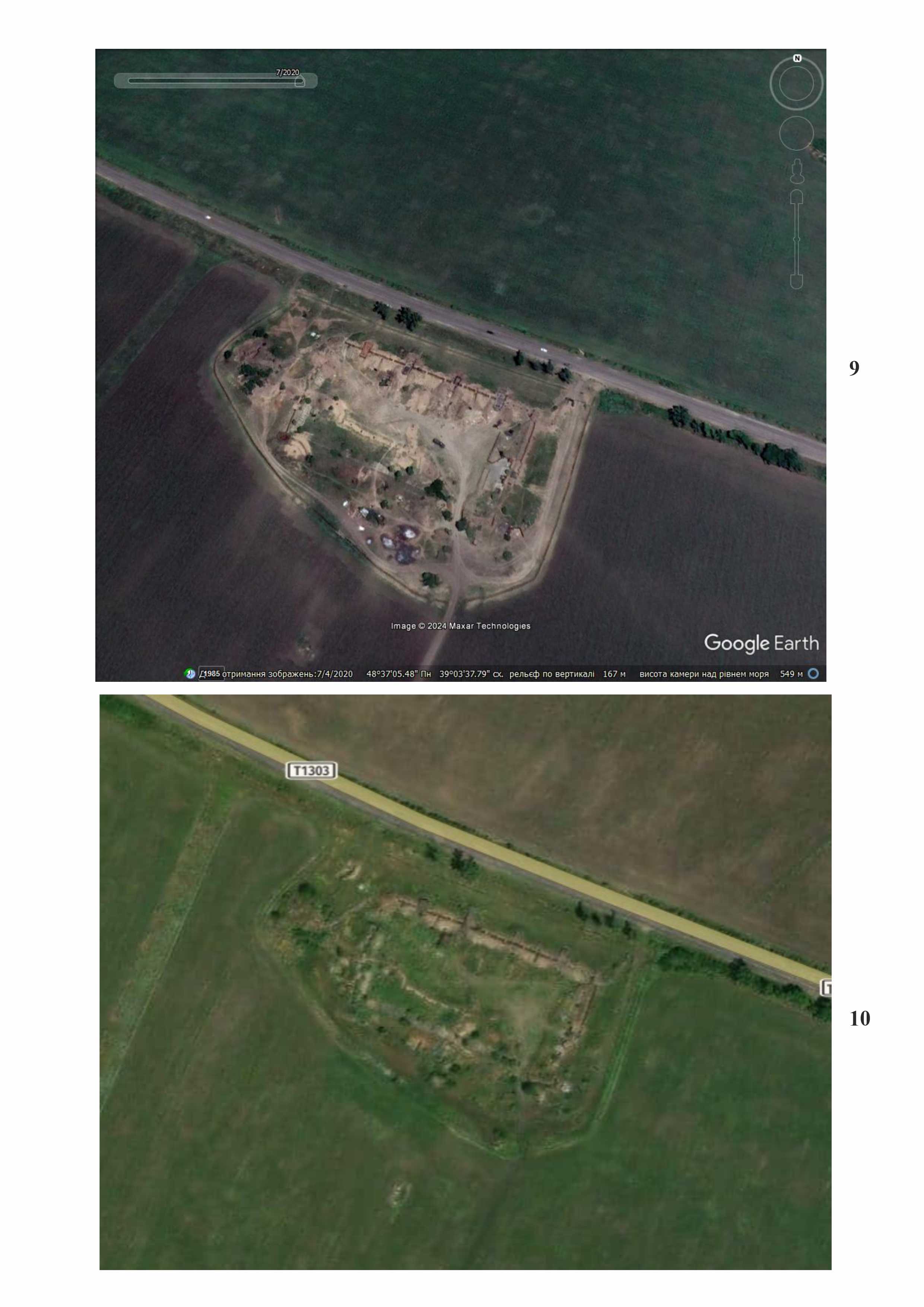
During the events of 2014, in the second half of July, the territory northwest of the barrow was shelled by artillery, as indicated by distinctive marks on the daytime surface (4). Since 2014, the territory where the barrow is located has been occupied by Russian troops. In April 2015, the construction of an observation post began to the northeast of the barrow across the R-66 highway, on an arable field on a local elevation (another barrow?). Simultaneously, a trench of unknown purpose was dug in the reclamation basin (5). As of July 2016, the observation post was no longer functioning (6). On August 20, 2017, a trench (7) was dug from the reclamation basin to the southern part of the barrow. There are no images from the period between September 2017 and March 2018, so it is not known when exactly the establishment of the strongpoint on the territory of the reclamation basin and the barrow began. However, in the image from April 2018, one can see that a lot of work had been done during this period: a new trench had been dug from the reclamation basin to the barrow and another trench had also been made at the top of the barrow itself (7). In a fairly clear satellite image from June 2019, one can see that the amount of damage to the barrow had increased because of new trenches (8). In the image from July 2020, it is visible that on the part of the reclamation basin, which is directed towards the R-66 highway, i.e., to the north, in the direction of the Siverskyi Donets river, on the left bank of which the units of the Armed Forces of Ukraine were stationed, four caponiers had appeared, two of which were already sheltering equipment (9). The image from 2022 shows that the strongpoint had ceased to function, its territory was overgrown with vegetation with no recent traces of military vehicles (10).
Thus, the barrow located 3.49 km southwest of the southwestern part of Zhovte village was used by Russian troops for military purposes. It is possible that ancient burials were destroyed by the strongpoint set up in this area.
Gallery


Additional files
information is clarified
Involved persons
information is clarified
Video gallery
information is clarified
Sources
information is clarified
Links
information is clarified