General information
Location
District - Severodonetsk
Community - Borivske village council, Severodonetsk city community
City - Borivske urban-type settlement
Date 2022
Kind of cultural heritage
ArchaeologicalObject type
ComplexesResearch zone
Luhansk regionMap
Object history and violation description
Protection number 4235
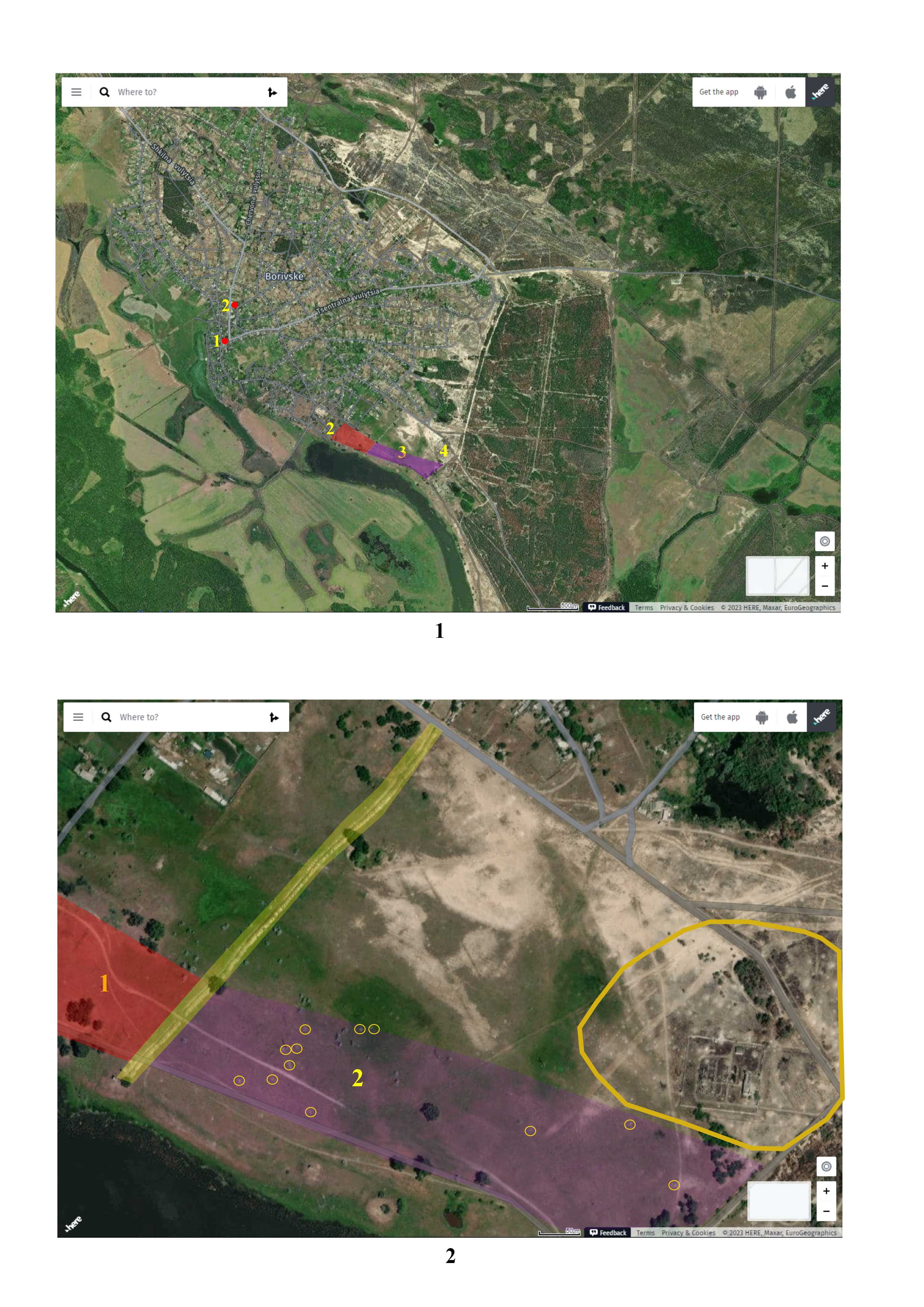
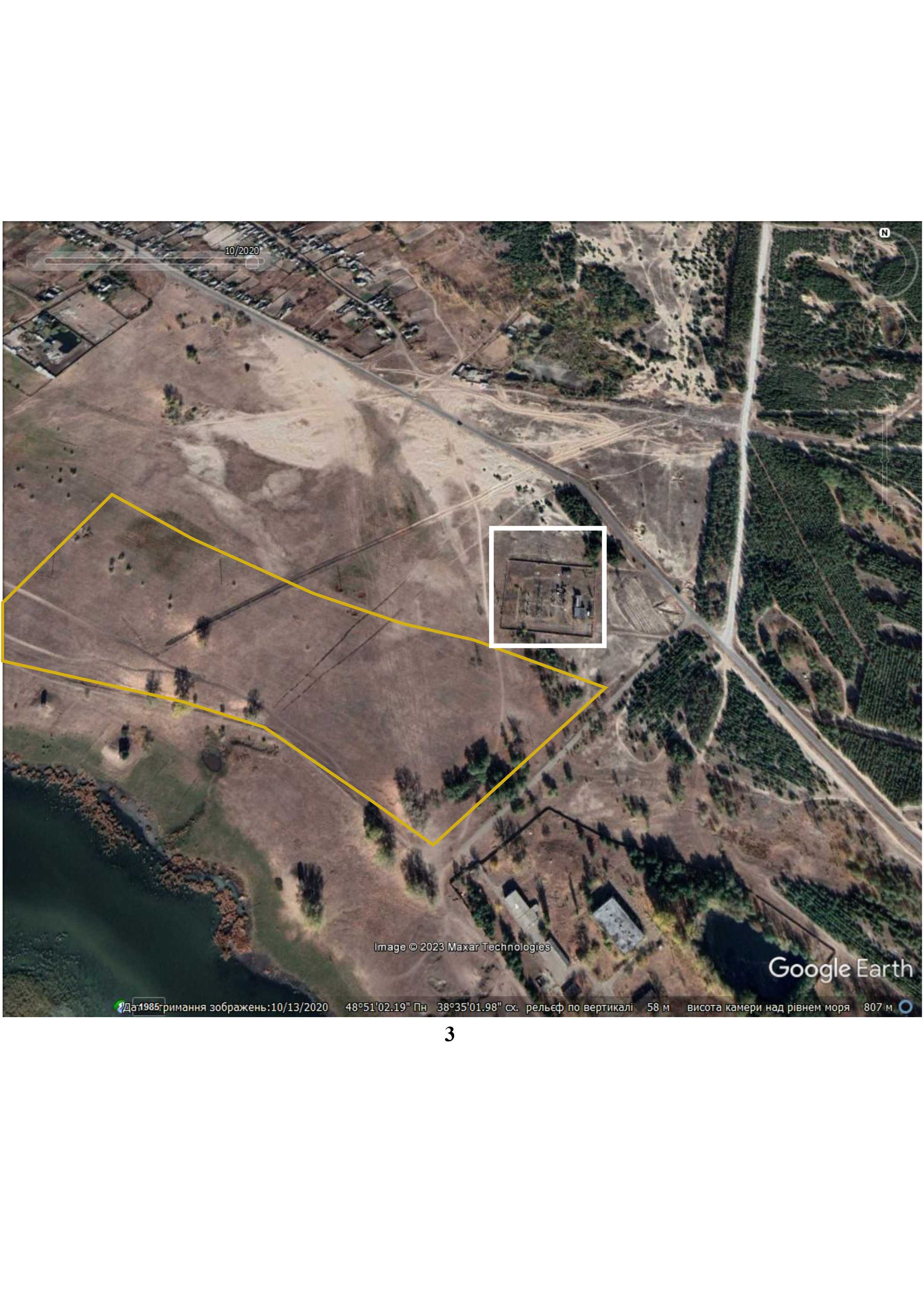
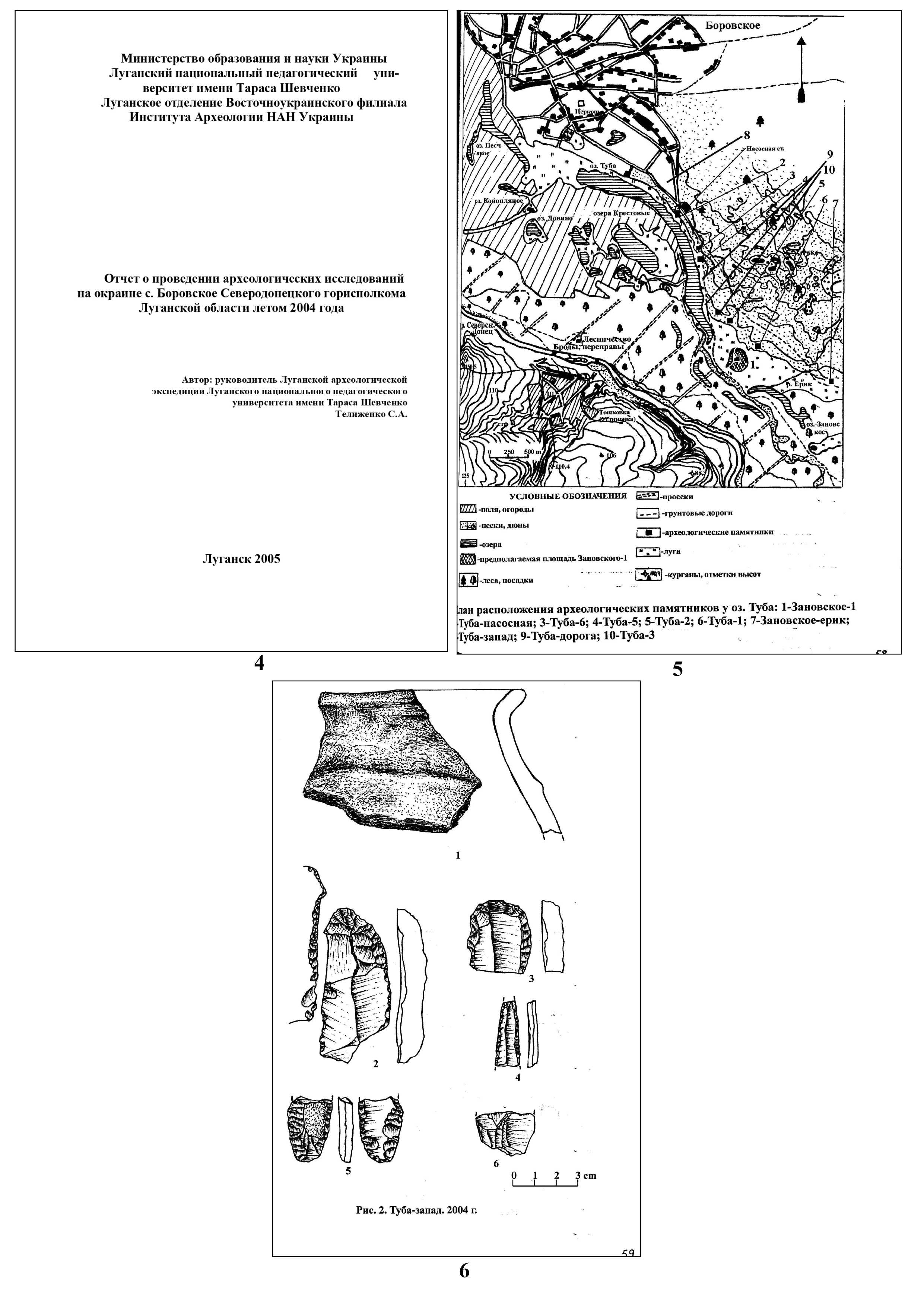
Location. The settlement is located in the southeastern part of Borivske urban-type settlement of the Borivske village council, Severodonetsk city community, Severodonetsk district, Luhansk region, 2.28 km southeast of the Church of Saint Nicholas (the central part of the settlement), which was consecrated in 1884 (according to other data, in 1885)1,2, and 2,4 km southeast of the village council. In the Register of Archeological Sites of Local Importance of Luhansk region, it is stated that the settlement is located “400–500 meters southeast of the urban-type settlement, near the substation.”
The terrace consists of sand. The left bank of the Siverskyi Donets river is full of settlements, sites and earthen burial places, ranging from the Neolithic to the Middle Ages. The settlement gravitates to the first floodplain terrace of Lake Tuba, which is part of the system of oxbow lakes on the left bank of the Siverskyi Donets river. Since the area of the settlement is not specified in the Register of Archeological Sites of Local Importance of Luhansk Region, we can say from our own experience that its southern border can be 50–60 meters away from the shoreline of Lake Tuba (a dirt road runs along this part of the lake), and its western part is limited by a trench that emerged in 2022 and behind which another settlement is located (protection number 4233). The eastern part of the settlement is bounded by an asphalt road, which is laid from the Severodonetsk-Bobrove highway to the water pumping station of the Lysychanskvodokanal communal enterprise. The northeastern part of the settlement is situated near the power station (approximately 30–40 meters to the south). The length of the trench that runs along the border of two settlements is 615 meters. Its origin is not established: it is difficult to determine whether it is related to a military object or whether it was dug for other reasons. Thus, the approximate dimensions of the settlement are 156x720x264x659 meters. The settlement is multi-layered. Given the fact that one settlement transitions into another, we can conclude that, in fact, it may be several settlements of different times that form a continuous chain.
Research history. The settlement was discovered and surveyed by scientists from the Voroshilovgrad (now Luhansk) Regional Museum of Local Lore, O. Gorelik and V. Vybornyy, in 1989. Records were drawn up and an article was prepared for the Register of Monuments of Voroshilovgrad Region. The passport of the settlement was not created.
In 2004, the participants of the Luhansk archaeological expedition (led by S. Telizhenko) collected archaeological artifacts dating back to the Neolithic and the Late Bronze Age in the territory of the settlement3. The settlement was named Tuba-zakhid (Tuba-West) because information about the existence of a settlement with a protection number in this location was unknown at that time. In total, 17 artifacts were discovered on the surface.
In 2016, the territory of the settlement was visually inspected by a monitoring mission organized by the Ukrainian Helsinki Human Rights Union and the International Partnership for Human Rights, which included a representative of the Institute of Archeology of the National Academy of Sciences of Ukraine. No damage to the cultural layer was detected at that time.
Events of 2022. Data on the occupation of Borivske is limited. It is known that the fighting on the outskirts of the village continued until the capture of Severodonetsk (June 25), when Ukrainian troops left the city and crossed over to the right bank of the Siverskyi Donets river4. Presumably, the withdrawal from the outskirts of Borivske took place a little earlier since Toshkivka town, located on the right bank, was occupied even before June 25. It is also known that on March 13, 2022, a Russian subversive group killed volunteer Oleksandr Kononov5.
By studying satellite images, one can see isolated traces of shell explosions in the area of the settlement, which could have caused damage to the cultural layer of the settlement. 12 explosion craters are visualized in low-resolution images. There are many more of them near the electrical substation, which was targeted by the Russian invaders and is nearly completely destroyed.
Gallery
Additional files
information is clarified
Involved persons
information is clarified
Video gallery
information is clarified
Sources
information is clarified
Links
- Excursion "Excursion to the historical sights of Borivske village, Luhansk region"
- Borivske (urban-type settlement)
- Telizhenko S.A. 2005. Report on archaeological research on the outskirts of Borovske village of Severodonetsk City Executive Committee, Luhansk region, summer 2004. Scientific archive of the Institute of Archeology of the National Academy of Sciences of Ukraine, 2004/19;
- Borivske (village)
- Memorial memory platform