General information
Location
District - Polohy district
Community - Rozivka village territorial community
City - Zaporizke village
Kind of cultural heritage
ArchaeologicalObject type
СonstructionsResearch zone
Zaporizhzhia regionMap
Object history and violation description
The territory near the Velykyi Luh (“Great Meadow”) boasts a huge number of mound necropolises (Table 1). The terms “barrow” or “grave” mean a round or long mound of earth erected over one or more burials. The first barrows emerged in the steppe zone of the Northern Black Sea region in the 4th millennium BC and existed until the 1st half of the 2nd millennium AD. The long-term use of such embankments as necropolises gave rise to barrow groups. The barrows contain layers of several historical eras. Burials carried out at different depths are divided into main and inlet burials. Each time, the barrow was filled in, stone stelae and wooden pillars were installed on its top. The barrow was repeatedly used during trizna – rites related to honoring the souls of buried ancestors.
Archaeological research in the territory of the Zaporizhzhia region was carried out in the 1970s and 1980s during the heyday of excavations associated with the growing construction of land amelioration structures. The same period marked the beginning of the inventory of cultural heritage sites.
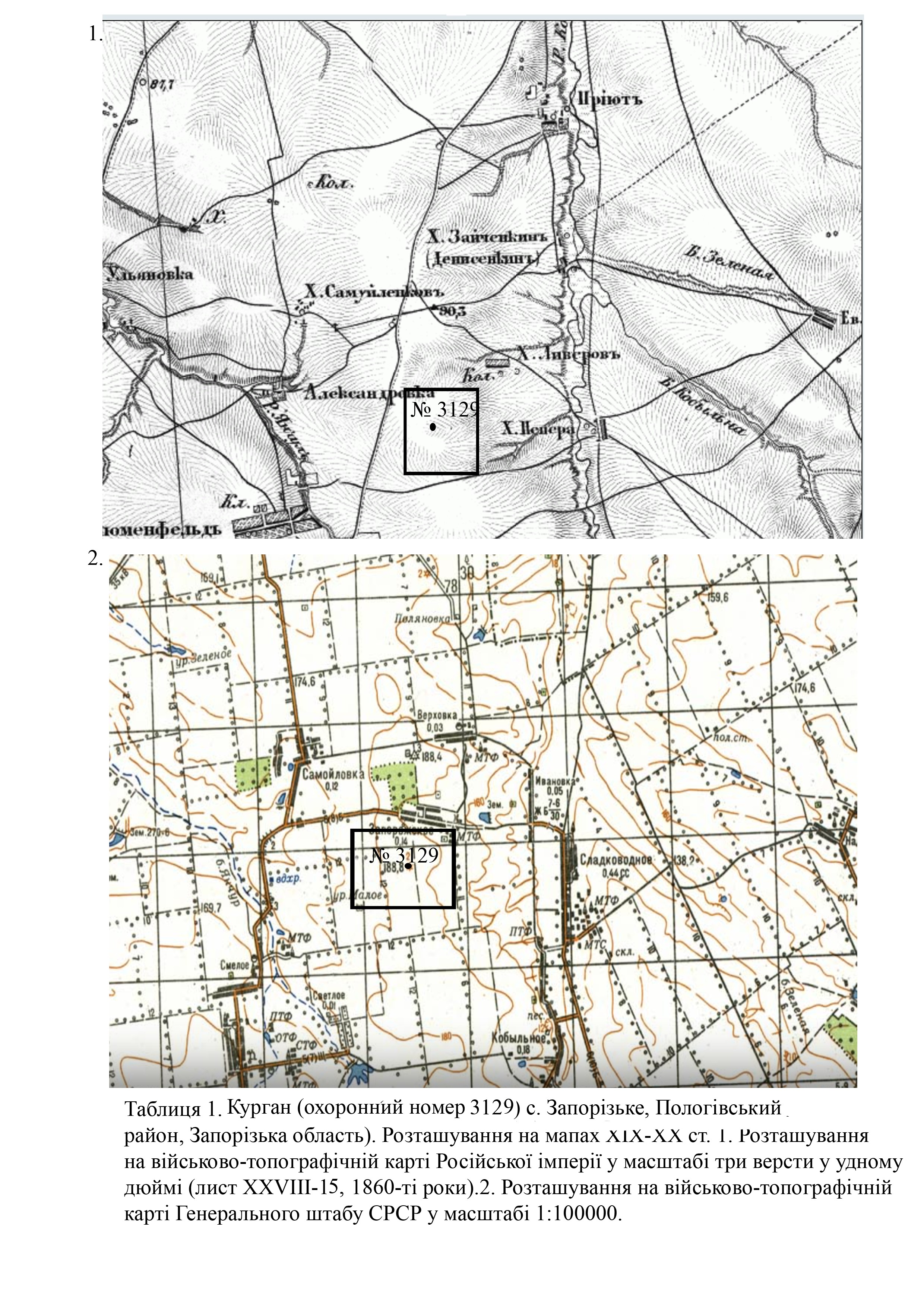
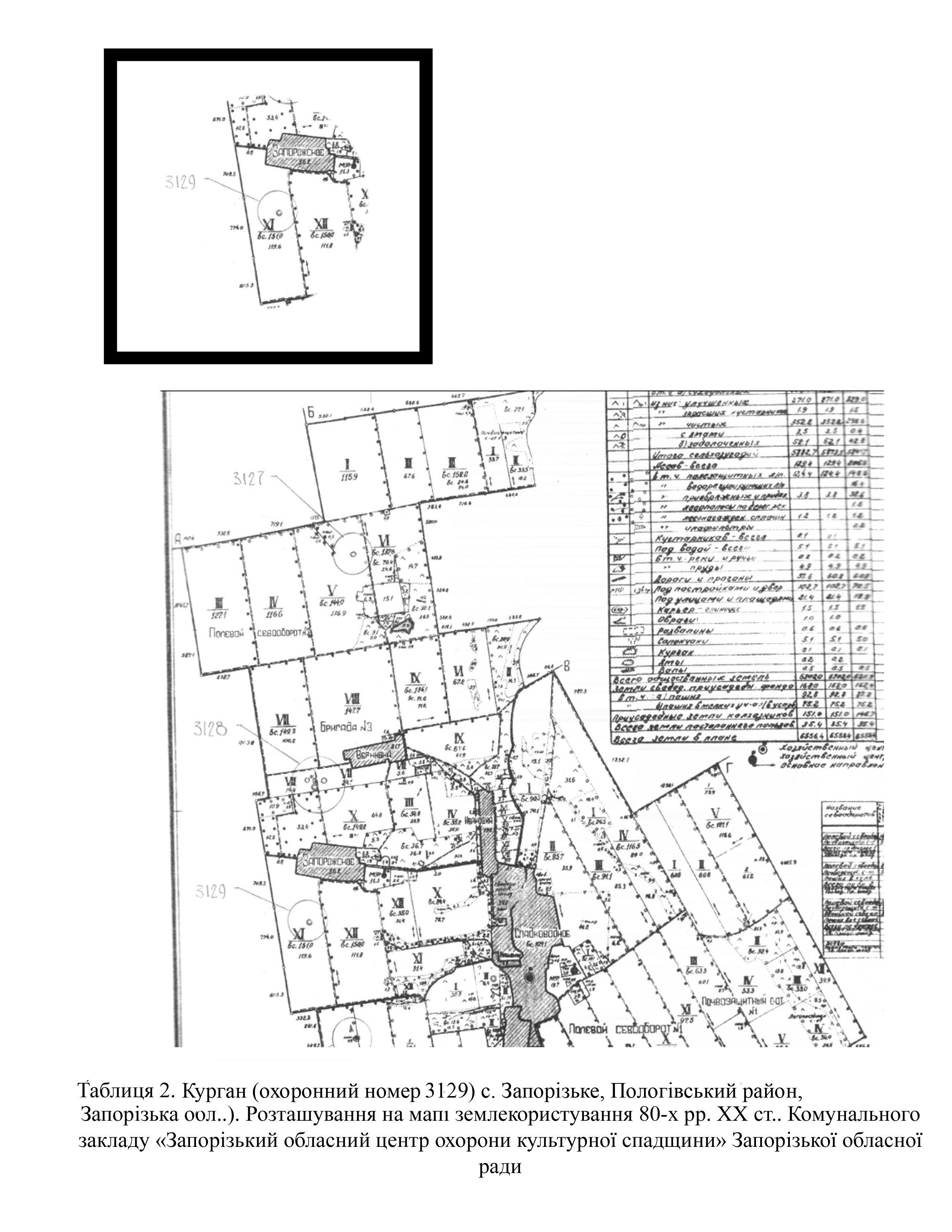
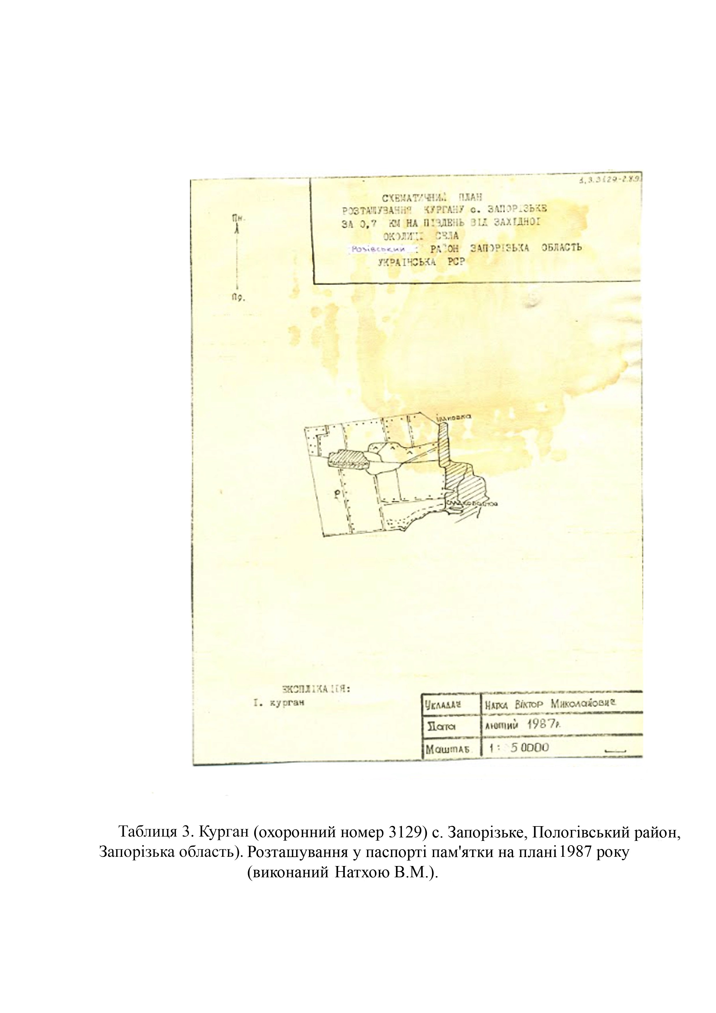
The barrow (protection No. 3129) was first examined by H. Toshchev and S. Andrukh, employees of the Zaporizhzhia State Pedagogical Institute, in 1986. In 1994, it was re-examined by A. Antonov, a senior research fellow of the Zaporizhzhia Regional Museum of Local Lore (Tables 2; 3).
In 1988, the executive committee of the Zaporizhzhia Regional Council of People's Deputies decided to include the barrow under protection number 3129 in the list of archaeological sites of local importance and approve its protection zone (No. 202 of June 28, 1988).
The barrow meets the criteria of authenticity and is also associated with historical events, beliefs and the development of culture in this area.
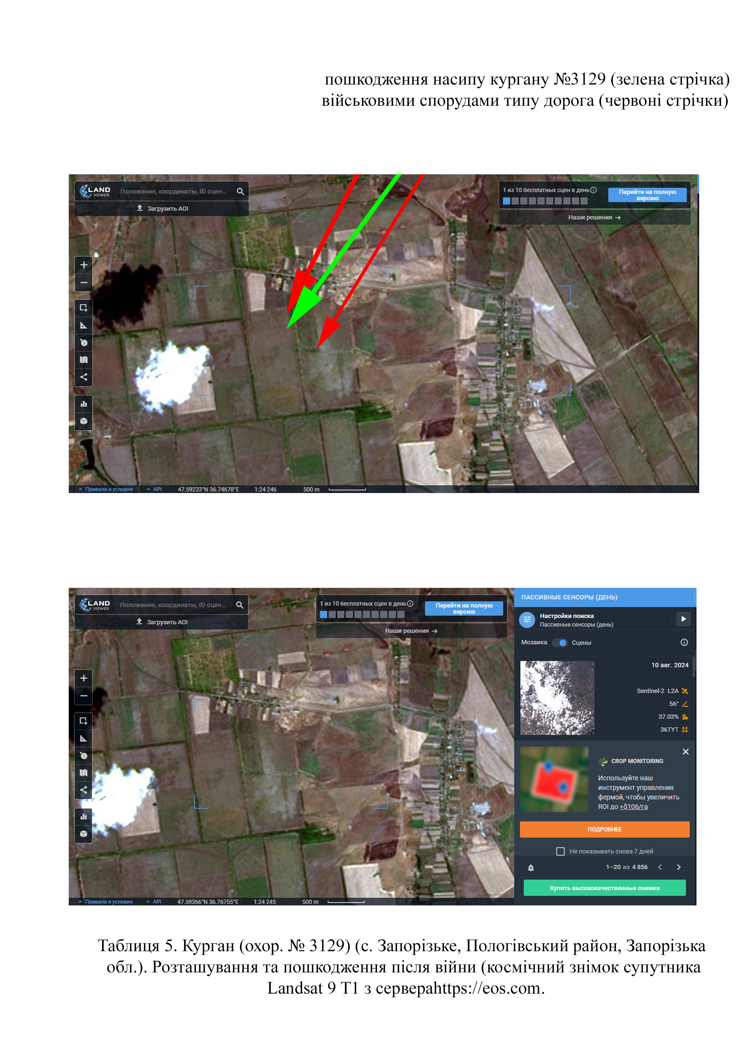
According to the site’s records, the barrow is of round shape in plan and segment-shaped in cross-section. It is located in the watershed area between the Kobylna and Yanchul rivers. Around the barrow, according to the 1987 records, a small soil excavation was detected (Tables 2; 3). Mound parameters are as follows: height – 1.2 meters; diameter – 30 meters.
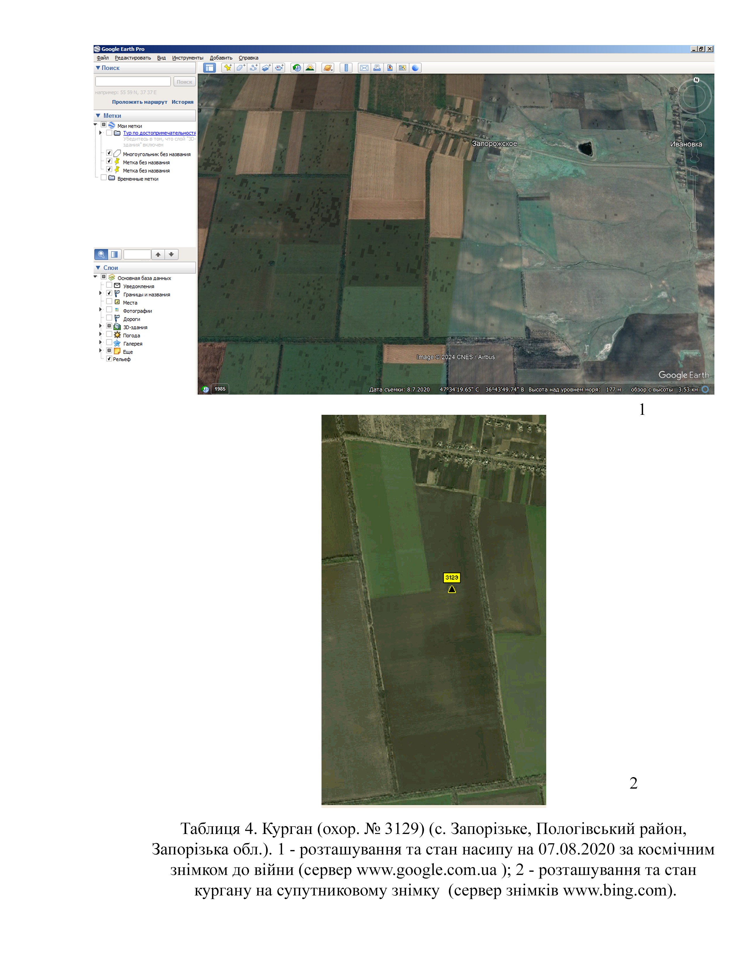
In the space images from August 7, 2020 from the Google Earth Pro server (https://google-earth-pro), it is clearly visible that the barrow had no significant damage (Table 4).
According to the map of the war chronology, during the southern offensive, in February 2022, the Rozivka district of the Zaporizhzhia region was occupied by Russian troops (Deep State map https://deepstatemap.live).
From 2022 through 2024, the following units were stationed here: the 143rd Motorized Rifle Regiment (military unit number 21634) from the 127th Motorized Rifle Division; the 394th Motorized Rifle Regiment; the 336th Separate Motorized Rifle Brigade; the 5th Combined Arms Army; penal military units Storm-Z, organized by former Russian Defense Minister Sergey Shoigu; the 1st Guards Motorized Rifle Regiment; the 34th Separate Motorized Rifle Brigade; the 14th Separate Special Forces Brigade (Russia’s Main Intelligence Directorate (GRU), military unit number 74854) (https://deepstatemap.live).
Thanks to high quality images, it can be established that part of the hemline of barrow No. 3129 was destroyed by a road that was laid out in this area (Table 5) (Landsat 9 T1 satellite image from https://eos.com made on August 9, 2024).
Gallery
Additional files
Involved persons
- - The construction of defensive installations was authorized by the occupation administration of the Rozivka village community of the Polohy district of the Zaporizhzhia region and the military occupiers.
Video gallery
information is clarified